File:Looking through the hole - geograph.org.uk - 799687.jpg
No higher resolution available.
Looking_through_the_hole_-_geograph.org.uk_-_799687.jpg (640 × 480 pixels, file size: 183 KB, MIME type: image/jpeg)
Captions
Captions
Add a one-line explanation of what this file represents
Summary
edit| Description |
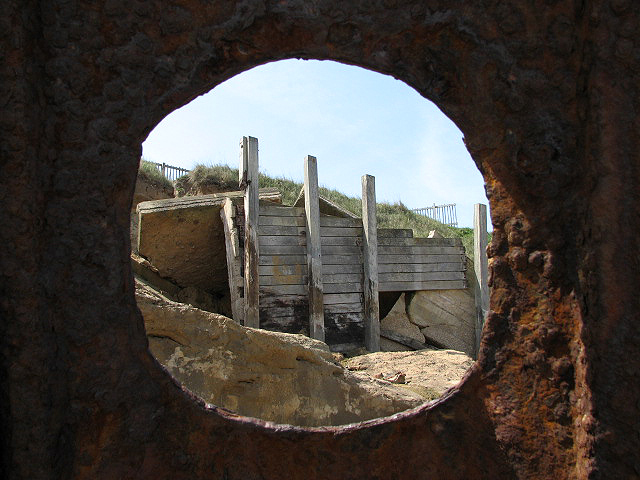
English: Looking through the hole Looking through a hole in the 799676 towards the access ramp which was destroyed in 2003 > 799611. – After the devastating floods in 1953, where 300 people lost their lives, the first sea defences were built and later extended, using greenheart and jarrah wood, combined with steel, for the groynes and revetments. The rate of erosion decreased but despite numerous repairs, large portions of the revetments have been destroyed during the last 40 years and a large bay has formed, due to cliff erosion, to the south of the village, which is on record as the first place in England where an average of two metres of cliff is lost per year. Lacking the funds for costly repairs, local authorities have decided to let nature run her course. |
||
| Date | |||
| Source | geograph.org.uk | ||
| Author | Evelyn Simak | ||
| Permission (Reusing this file) |
This file is licensed under the Creative Commons Attribution-Share Alike 2.0 Generic license. Attribution: Evelyn Simak
|
||
| Other versions |
|
||
| Attribution (required by the license) | Evelyn Simak / Looking through the hole / | ||


| Camera location | | View this and other nearby images on: OpenStreetMap |
|---|
_heading:247.00&language=en)
| Object location | | View this and other nearby images on: OpenStreetMap |
|---|
_heading:247.00&language=en)
File history
Click on a date/time to view the file as it appeared at that time.
| Date/Time | Thumbnail | Dimensions | User | Comment | |
|---|---|---|---|---|---|
| current | 05:18, 20 February 2011 | | 640 × 480 (183 KB) | GeographBot (talk | contribs) | == {{int:filedesc}} == {{Information |description={{en|1=Looking through the hole Looking through a hole in the 799676 towards the access ramp which was destroyed in 2003 > 799611. After the devastating floods in 1953, where 300 people lost the |
You cannot overwrite this file.
File usage on Commons
The following 2 pages use this file: