File:Looking up the Bryngwyn incline, near Glandwr (geograph 6248606).jpg
Size of this preview: 800 × 600 pixels. Other resolutions: 320 × 240 pixels | 640 × 480 pixels | 1,024 × 768 pixels | 1,280 × 960 pixels | 1,600 × 1,200 pixels.
Original file (1,600 × 1,200 pixels, file size: 670 KB, MIME type: image/jpeg)
Captions
Captions
Add a one-line explanation of what this file represents
Summary edit
.jpg&action=edit§ion=1)
| Description |
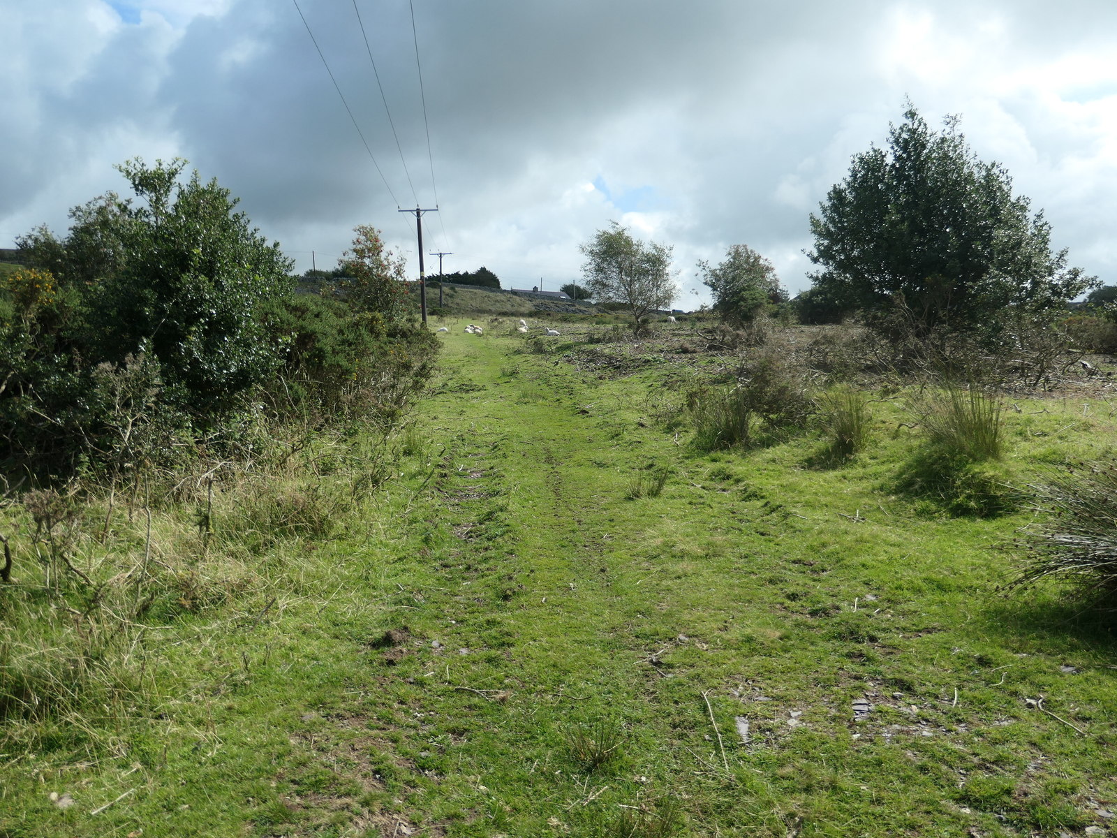
English: Looking up the Bryngwyn incline, near Glandwr The Bryngwyn [narrow gauge railway] branch was built to carry slate from the quarries to the coast. The line opened in 1877 and closed in 1937. This section was a double incline, rising 80 metres in half a mile. Only three full slate wagons could be lowered at a time. It is now part of the Cangen Bryngwyn Branch slate railway trail. You can follow the route of the railway from Tryfan Junction, through Rhostryfan and Bryngwyn to the site of the drumhead at the top of the incline. The trail was created by Cyngor Cymuned Llanwnda / Llanwnda Community Council. |
| Date | |
| Source | From geograph.org.uk |
| Author | Christine Johnstone |
| Permission (Reusing this file) |
Creative Commons Attribution Share-alike license 2.0 |
| Attribution (required by the license) | Christine Johnstone / Looking up the Bryngwyn incline, near Glandwr / |
| Camera location | | View this and other nearby images on: OpenStreetMap |
|---|
.jpg¶ms=053.079826_N_-004.236023_E_globe:Earth_type:camera_source:geograph-osgb36(SH50325596)_heading:112.00&language=en)
| Object location | | View this and other nearby images on: OpenStreetMap |
|---|
.jpg¶ms=053.079750_N_-004.235270_E_globe:Earth_class:object_type:object_source:geograph-osgb36(SH50375595)_heading:112.00&language=en)
Licensing edit
.jpg&action=edit§ion=2)

|
This image was taken from the Geograph project collection. See this photograph's page on the Geograph website for the photographer's contact details. The copyright on this image is owned by Christine Johnstone and is licensed for reuse under the Creative Commons Attribution-ShareAlike 2.0 license.
|
This file is licensed under the Creative Commons Attribution-Share Alike 2.0 Generic license.
Attribution: Christine Johnstone
- You are free:
- to share – to copy, distribute and transmit the work
- to remix – to adapt the work
- Under the following conditions:
- attribution – You must give appropriate credit, provide a link to the license, and indicate if changes were made. You may do so in any reasonable manner, but not in any way that suggests the licensor endorses you or your use.
- share alike – If you remix, transform, or build upon the material, you must distribute your contributions under the same or compatible license as the original.
File history
Click on a date/time to view the file as it appeared at that time.
| Date/Time | Thumbnail | Dimensions | User | Comment | |
|---|---|---|---|---|---|
| current | 22:13, 5 November 2020 | | 1,600 × 1,200 (670 KB) | Lamberhurst (talk | contribs) | Transferred from geograph.co.uk using [https://tools.wmflabs.org/geograph2commons/ geograph2commons] |
You cannot overwrite this file.
File usage on Commons
The following 3 pages use this file:
.jpg&oldid=713893258)