File:Louth to Mablethorpe railway trackbed - geograph.org.uk - 1031485.jpg
No higher resolution available.
Louth_to_Mablethorpe_railway_trackbed_-_geograph.org.uk_-_1031485.jpg (640 × 480 pixels, file size: 102 KB, MIME type: image/jpeg)
Captions
Captions
Add a one-line explanation of what this file represents
Summary edit
| Description |
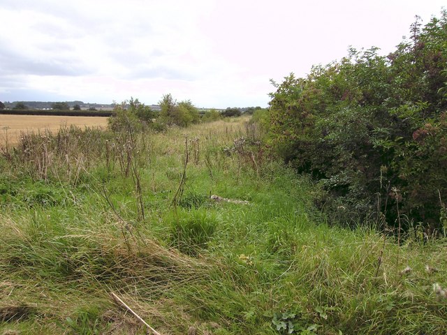
English: Louth to Mablethorpe railway trackbed. Taken from the former level crossing as seen in 1031474 and looking west showing one of the few remains of the northern section of the "Mablethorpe Loop", which closed in 1960. |
| Date | |
| Source | From geograph.org.uk |
| Author | John Beal |
| Attribution (required by the license) | John Beal / Louth to Mablethorpe railway trackbed / |
| Camera location | | View this and other nearby images on: OpenStreetMap |
|---|
_heading:270.00&language=en)
| Object location | | View this and other nearby images on: OpenStreetMap |
|---|
_heading:270.00&language=en)
Licensing edit

|
This image was taken from the Geograph project collection. See this photograph's page on the Geograph website for the photographer's contact details. The copyright on this image is owned by John Beal and is licensed for reuse under the Creative Commons Attribution-ShareAlike 2.0 license.
|
This file is licensed under the Creative Commons Attribution-Share Alike 2.0 Generic license.
Attribution: John Beal
- You are free:
- to share – to copy, distribute and transmit the work
- to remix – to adapt the work
- Under the following conditions:
- attribution – You must give appropriate credit, provide a link to the license, and indicate if changes were made. You may do so in any reasonable manner, but not in any way that suggests the licensor endorses you or your use.
- share alike – If you remix, transform, or build upon the material, you must distribute your contributions under the same or compatible license as the original.

|
The categories of this image need checking. You can do so here.
|
File history
Click on a date/time to view the file as it appeared at that time.
| Date/Time | Thumbnail | Dimensions | User | Comment | |
|---|---|---|---|---|---|
| current | 18:19, 23 February 2011 | | 640 × 480 (102 KB) | GeographBot (talk | contribs) | == {{int:filedesc}} == {{Information |description={{en|1=Louth to Mablethorpe railway trackbed Taken from the former level crossing as seen in 1031474 and looking west showing one of the few remains of the northern section of the "Mablethorpe Loop", w |
You cannot overwrite this file.
File usage on Commons
There are no pages that use this file.