File:Low Countries 1740.png

Size of this preview: 800 × 566 pixels. Other resolutions: 320 × 226 pixels | 640 × 453 pixels | 813 × 575 pixels.
Original file (813 × 575 pixels, file size: 225 KB, MIME type: image/png)
Captions
Captions
Add a one-line explanation of what this file represents
Summary
edit
| Description |
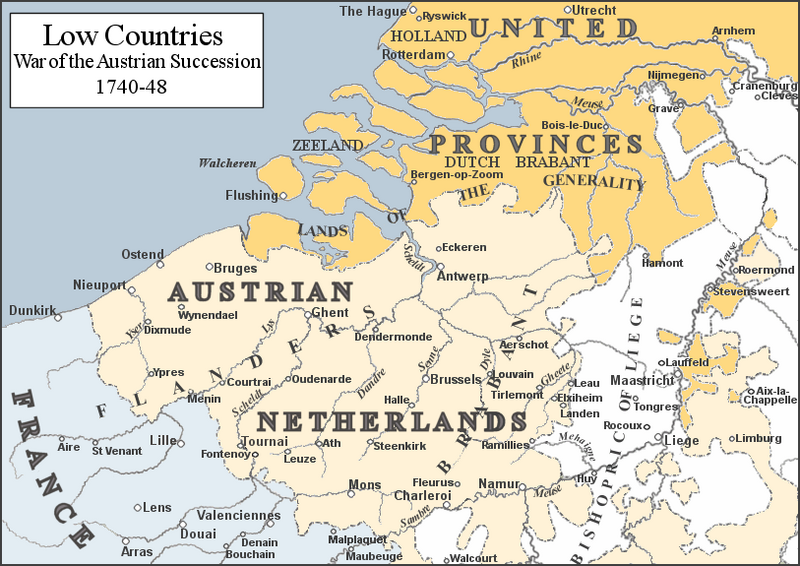
English: Map of the Low Countries mid-18th Century. Based on map in G. M. Trevelyan's England Under Queen Anne: Blenheim |
| Date | |
| Source | Own work |
| Author | Rebel Redcoat |
| Other versions | File:Low Countries 1740 dot Fontenoy.png |
Licensing
edit
| I, the copyright holder of this work, release this work into the public domain. This applies worldwide. In some countries this may not be legally possible; if so: I grant anyone the right to use this work for any purpose, without any conditions, unless such conditions are required by law. |
File history
Click on a date/time to view the file as it appeared at that time.
| Date/Time | Thumbnail | Dimensions | User | Comment | |
|---|---|---|---|---|---|
| current | 20:32, 1 June 2016 | | 813 × 575 (225 KB) | Hans Erren (talk | contribs) | colours in present day limburg corrected |
| 18:10, 14 May 2010 |  | 813 × 575 (215 KB) | Rebel Redcoat~commonswiki (talk | contribs) | {{Information |Description={{en|1=Map of the Low Countries mid-18th Century. Based on map in G. M. Trevelyan's ''England Under Queen Anne: Blenheim''}} |Source={{own}} |Author=Rebel Redcoat |Date=14 May 2010 |Permission= |other_vers |
You cannot overwrite this file.
File usage on Commons
There are no pages that use this file.
File usage on other wikis
The following other wikis use this file:
- Usage on azb.wikipedia.org
- Usage on de.wikipedia.org
- Usage on en.wikipedia.org
- Usage on et.wikipedia.org
- Usage on fr.wikipedia.org
- Usage on he.wikipedia.org
- Usage on ja.wikipedia.org
- Usage on pt.wikipedia.org
- Usage on ru.wikipedia.org
- Usage on sh.wikipedia.org
- Usage on sl.wikipedia.org