File:Lower Mississippi Delta Region.gif
No higher resolution available.
Lower_Mississippi_Delta_Region.gif (255 × 304 pixels, file size: 5 KB, MIME type: image/gif)
Captions
Captions
Add a one-line explanation of what this file represents
Summary edit
| Description |
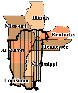
English: Part of the Draft Heritage Study and Environmental Assessment |
| Date | |
| Source | http://www.nps.gov/history/delta/maps/map_area.htm |
| Author | Draft Heritage Study and Environmental Assessment, NPS |
Licensing edit
| This image or media file contains material based on a work of a National Park Service employee, created as part of that person's official duties. As a work of the U.S. federal government, such work is in the public domain in the United States. See the NPS website and NPS copyright policy for more information. |
File history
Click on a date/time to view the file as it appeared at that time.
| Date/Time | Thumbnail | Dimensions | User | Comment | |
|---|---|---|---|---|---|
| current | 20:34, 31 July 2009 | | 255 × 304 (5 KB) | Edmund Ferman (talk | contribs) | {{Information |Description={{en|1=Part of the Draft Heritage Study and Environmental Assessment}} |Source=http://www.nps.gov/history/delta/maps/map_area.htm |Author=Draft Heritage Study and Environmental Assessment, NPS |Date=1996 |Permission= |other_vers |
You cannot overwrite this file.
File usage on Commons
There are no pages that use this file.
File usage on other wikis
The following other wikis use this file:
- Usage on de.wikipedia.org
- Usage on it.wikipedia.org