File:Lowland Point 2 - geograph.org.uk - 1266926.jpg
No higher resolution available.
Lowland_Point_2_-_geograph.org.uk_-_1266926.jpg (640 × 425 pixels, file size: 72 KB, MIME type: image/jpeg)
Captions
Captions
Add a one-line explanation of what this file represents
Summary
edit
| Description |
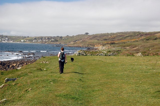
English: Lowland Point 2 Lowland Point is (unusually for this area) a flat stretch of land formed in geological times by the slumping of old sea cliffs, now half a kilometre or so from the present shore line. The start of these sea cliffs can be seen towards the right. The material from the cliffs was then overlaid by a deposit of loess. All this is protected from erosion by the resistant rocks at the point. The result is a small area of very hospitable, fertile land which was quite heavily populated in prehistoric times. There are many old field boundaries and hut circles to be seen. The land is now owned by the National Trust. |
| Date | |
| Source | From geograph.org.uk |
| Author | Trevor Harris |
| Attribution (required by the license) | Trevor Harris / Lowland Point 2 / |
| Camera location | | View this and other nearby images on: OpenStreetMap |
|---|
_heading:247.00&language=en)
| Object location | | View this and other nearby images on: OpenStreetMap |
|---|
_heading:247.00&language=en)
Licensing
edit

|
This image was taken from the Geograph project collection. See this photograph's page on the Geograph website for the photographer's contact details. The copyright on this image is owned by Trevor Harris and is licensed for reuse under the Creative Commons Attribution-ShareAlike 2.0 license.
|
This file is licensed under the Creative Commons Attribution-Share Alike 2.0 Generic license.
Attribution: Trevor Harris
- You are free:
- to share – to copy, distribute and transmit the work
- to remix – to adapt the work
- Under the following conditions:
- attribution – You must give appropriate credit, provide a link to the license, and indicate if changes were made. You may do so in any reasonable manner, but not in any way that suggests the licensor endorses you or your use.
- share alike – If you remix, transform, or build upon the material, you must distribute your contributions under the same or compatible license as the original.
File history
Click on a date/time to view the file as it appeared at that time.
| Date/Time | Thumbnail | Dimensions | User | Comment | |
|---|---|---|---|---|---|
| current | 23:49, 26 February 2011 | | 640 × 425 (72 KB) | GeographBot (talk | contribs) | == {{int:filedesc}} == {{Information |description={{en|1=Lowland Point 2 Lowland Point is (unusually for this area) a flat stretch of land formed in geological times by the slumping of old sea cliffs, now half a kilometre or so from the present shore line |
You cannot overwrite this file.
File usage on Commons
There are no pages that use this file.