File:Lubinsche Karte.jpg
Size of this preview: 800 × 546 pixels. Other resolutions: 320 × 218 pixels | 640 × 437 pixels | 1,024 × 699 pixels | 1,280 × 873 pixels | 2,560 × 1,747 pixels | 3,500 × 2,388 pixels.
Original file (3,500 × 2,388 pixels, file size: 2.88 MB, MIME type: image/jpeg)
Captions
Captions
Add a one-line explanation of what this file represents
Summary edit
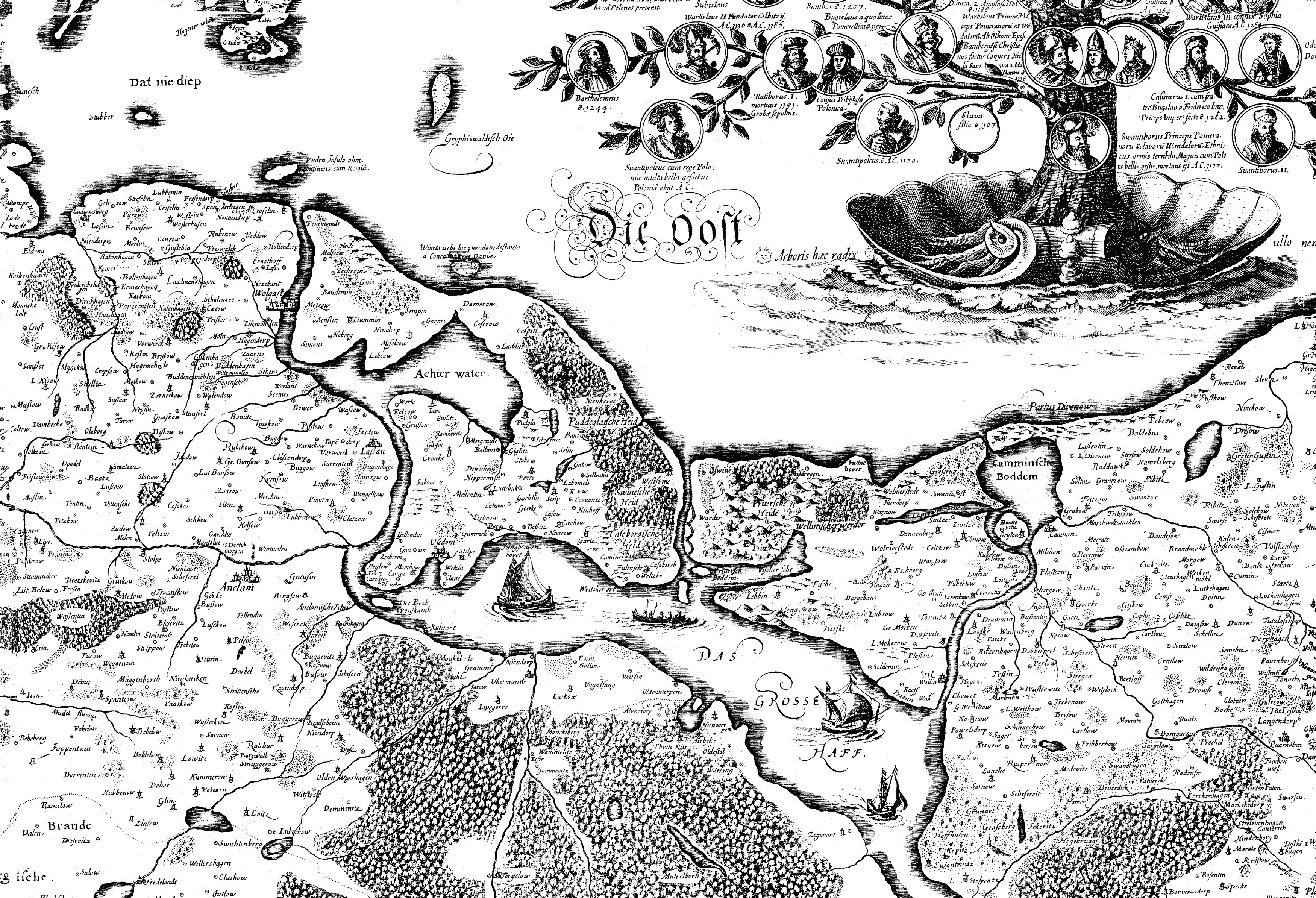
| Description |
Deutsch: Der Lassaner Winkel auf einem Ausschnitt der Lubinschen Karte des
|
||||||||||||||||||||
| Date | |||||||||||||||||||||
| Source | http://archeo.edu.pl/lubinus/6.jpg | ||||||||||||||||||||
| Author | Eilhard Lubinus (23 March 1565 – 2 June 1621) | ||||||||||||||||||||

| Camera location | | View this and other nearby images on: OpenStreetMap |
|---|
Licensing edit
|
The author died in 1621, so this work is in the public domain in its country of origin and other countries and areas where the copyright term is the author's life plus 100 years or fewer. This work is in the public domain in the United States because it was published (or registered with the U.S. Copyright Office) before January 1, 1929. | |
| This file has been identified as being free of known restrictions under copyright law, including all related and neighboring rights. | |
File history
Click on a date/time to view the file as it appeared at that time.
| Date/Time | Thumbnail | Dimensions | User | Comment | |
|---|---|---|---|---|---|
| current | 17:50, 25 May 2016 | | 3,500 × 2,388 (2.88 MB) | Weltalf (talk | contribs) | User created page with UploadWizard |
You cannot overwrite this file.
File usage on Commons
There are no pages that use this file.