File:Lublin location map.png
No higher resolution available.
Lublin_location_map.png (402 × 458 pixels, file size: 253 KB, MIME type: image/png)
Captions
Captions
Add a one-line explanation of what this file represents
Summary edit
| Description |
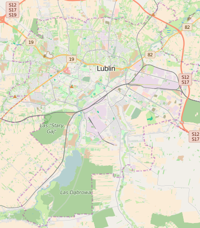
English: OpenStreetMap location map of Lublin, Poland:
|
| Date | |
| Source | OpenStreetMap |
| Author | OpenStreetMap contributors |
Licensing edit
| This work contains information from OpenStreetMap, which is made available under the Open Database License (ODbL).
The ODbL does not require any particular license for maps produced from ODbL data. Prior to 1 August 2020, map tiles produced by the OpenStreetMap Foundation were licensed under the CC-BY-SA-2.0 license. Maps produced by other people may be subject to other licences. |
File history
Click on a date/time to view the file as it appeared at that time.
| Date/Time | Thumbnail | Dimensions | User | Comment | |
|---|---|---|---|---|---|
| current | 09:33, 22 May 2016 | | 402 × 458 (253 KB) | EBin (talk | contribs) | Update map using http://render.openstreetmap.org/cgi-bin/export?bbox=22.452,51.139,22.675,51.298&scale=220000&format=png |
| 15:34, 10 November 2012 |  | 402 × 458 (181 KB) | Powerek38 (talk | contribs) | User created page with UploadWizard |
You cannot overwrite this file.
File usage on Commons
There are no pages that use this file.
File usage on other wikis
The following other wikis use this file:
- Usage on fr.wikipedia.org
- Usage on ja.wikipedia.org
- Usage on pl.wikipedia.org
- Katolicki Uniwersytet Lubelski Jana Pawła II
- Lublin (KL)
- Uniwersytet Marii Curie-Skłodowskiej
- Jezioro Zemborzyckie
- Muzeum Wsi Lubelskiej w Lublinie
- Politechnika Lubelska
- Uniwersytet Medyczny w Lublinie
- Uniwersytet Przyrodniczy w Lublinie
- Teatr im. Juliusza Osterwy w Lublinie
- Fabryka Samochodów Ciężarowych w Lublinie
- Lubella (przedsiębiorstwo)
- Perła – Browary Lubelskie
- Rezerwat przyrody Stasin
- Ośrodek „Brama Grodzka – Teatr NN”
- Górki Czechowskie
- Las Dąbrowa (Lublin)
- Chorągiew Lubelska ZHP
- Lublin Główny
- Biblioteka Uniwersytecka Katolickiego Uniwersytetu Lubelskiego Jana Pawła II
- Metropolia lubelska
- Osiedle Niepodległości (Lublin)
- Elektrociepłownia Lublin-Wrotków
- Lubelska Akademia WSEI
- Synagoga Chewra Nosim w Lublinie
- Osiedle Poręba
- I Liceum Ogólnokształcące im. Stanisława Staszica w Lublinie
- Wikipedysta:Matman z Lublina/brudnopis
- Krakowskie Przedmieście w Lublinie
- Wikipedysta:HaLevi/brudnopis
- Synagoga Maharszala w Lublinie
- Synagoga Maharama w Lublinie
- V Liceum Ogólnokształcące im. Marii Skłodowskiej-Curie w Lublinie
- Jeszywas Chachmej Lublin
- Synagoga w Jeszywas Chachmej Lublin
- XXI Liceum Ogólnokształcące im. św. Stanisława Kostki w Lublinie
- Wyższe Seminarium Duchowne Diecezji Zamojsko-Lubaczowskiej w Lublinie
- Wyższa Szkoła Przedsiębiorczości i Administracji w Lublinie
- II Liceum Ogólnokształcące im. Hetmana Jana Zamoyskiego w Lublinie
- Mała Synagoga w Jeszywas Chachmej Lublin
- Szpital Żydowski w Lublinie
- Synagoga Szywe Kryjem w Lublinie
- Żydowski Dom Starców i Sierot w Lublinie
- Instytut Agrofizyki im. Bohdana Dobrzańskiego Polskiej Akademii Nauk
View more global usage of this file.