File:Luftbild Beyenburger Stausee.jpg
Size of this preview: 800 × 533 pixels. Other resolutions: 320 × 213 pixels | 640 × 427 pixels | 1,024 × 683 pixels | 1,280 × 853 pixels | 2,560 × 1,707 pixels | 5,460 × 3,640 pixels.
Original file (5,460 × 3,640 pixels, file size: 12.28 MB, MIME type: image/jpeg)
File information
Structured data
Captions
Summary
editDescriptionLuftbild Beyenburger Stausee.jpg |
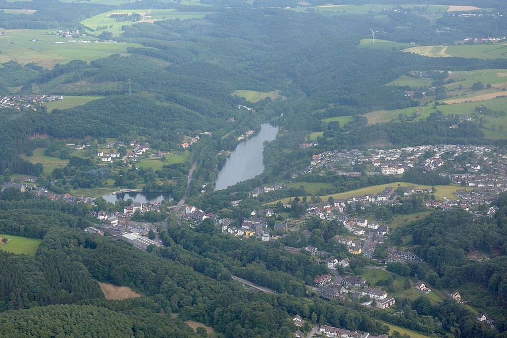
Deutsch: Luftaufnahme: Blick nach Südosten über den Beyenburger Stausee (Bildmitte) im Verlauf der Wupper in Nordrhein-Westfalen. Abgebildet sind Teile der Stadtgebiete von Wuppertal, Schwelm, Ennepetal und Radevormwald; die Wupper bildet hier die wesentliche Grenze zwischen dem Ennepe-Ruhr-Kreis (mit den Städten Schwelm und Ennepetal) und der kreisfreien Stadt Wuppertal (mit dem Ortsteil Beyenburg im Vordergrund). |
Date | Taken on 24 July 2015 |
Source | Own work |
Author | Krd |
Camera location | 51° 15′ 33.47″ N, 7° 16′ 21.32″ E | View this and other nearby images on: OpenStreetMap | 51.259297; 7.272588 |
---|
Licensing
editThis file is licensed under the Creative Commons Attribution-Share Alike 4.0 International license.
- You are free:
- to share – to copy, distribute and transmit the work
- to remix – to adapt the work
- Under the following conditions:
- attribution – You must give appropriate credit, provide a link to the license, and indicate if changes were made. You may do so in any reasonable manner, but not in any way that suggests the licensor endorses you or your use.
- share alike – If you remix, transform, or build upon the material, you must distribute your contributions under the same or compatible license as the original.
Annotations InfoField | This image is annotated: View the annotations at Commons |
983
1209
2123
1086
5460
3640
Deutsch: Beyenburger Stausee
48
2711
1522
908
5460
3640
Deutsch: Stadtgebiet Schwelm
27
970
2375
949
5460
3640
Deutsch: Stadtgebiet Ennepetal
307
300
1188
239
5460
3640
Deutsch: Remlingrade (Stadtgebiet Radevormwald)
3392
1509
2054
1660
5460
3640
Wuppertal-Beyenburg
3945
260
164
246
5460
3640
Deutsch: Windkraftanlage bei Oberdahl (Radevormwald)
20
1892
293
253
5460
3640
Deutsch: Beyenburger Klosterkirche
3044
2964
696
403
5460
3640
Beyenburger Brücke
File history
Click on a date/time to view the file as it appeared at that time.
Date/Time | Thumbnail | Dimensions | User | Comment | |
---|---|---|---|---|---|
current | 16:13, 6 August 2015 | 5,460 × 3,640 (12.28 MB) | Krd (talk | contribs) | upload | |
16:02, 6 August 2015 | 6,000 × 4,000 (11.49 MB) | Krd (talk | contribs) | upload |
You cannot overwrite this file.
File usage on Commons
The following page uses this file:
File usage on other wikis
The following other wikis use this file:
- Usage on de.wikipedia.org
Metadata
This file contains additional information such as Exif metadata which may have been added by the digital camera, scanner, or software program used to create or digitize it. If the file has been modified from its original state, some details such as the timestamp may not fully reflect those of the original file. The timestamp is only as accurate as the clock in the camera, and it may be completely wrong.
Camera manufacturer | NIKON CORPORATION |
---|---|
Camera model | NIKON D7100 |
Author | krd |
Copyright holder | krd / cc-by-sa-3.0 |
Exposure time | 1/1,000 sec (0.001) |
F-number | f/8 |
ISO speed rating | 800 |
Date and time of data generation | 16:59, 24 July 2015 |
Lens focal length | 45 mm |
Latitude | 51° 15′ 33.47″ N |
Longitude | 7° 16′ 21.32″ E |
Altitude | 731 meters above sea level |
Orientation | Normal |
Software used | Photivo |
File change date and time | 16:59, 24 July 2015 |
Y and C positioning | Co-sited |
Exposure Program | Manual |
Exif version | 2.3 |
Date and time of digitizing | 16:59, 24 July 2015 |
Meaning of each component |
|
Image compression mode | 4 |
APEX exposure bias | 0 |
Maximum land aperture | 4.5 APEX (f/4.76) |
Metering mode | Spot |
Light source | Unknown |
Flash | Flash did not fire, compulsory flash suppression |
DateTime subseconds | 70 |
DateTimeOriginal subseconds | 70 |
DateTimeDigitized subseconds | 70 |
Supported Flashpix version | 1 |
Color space | sRGB |
Sensing method | One-chip color area sensor |
File source | Digital still camera |
Scene type | A directly photographed image |
Custom image processing | Normal process |
Exposure mode | Manual exposure |
White balance | Auto white balance |
Digital zoom ratio | 1 |
Focal length in 35 mm film | 67 mm |
Scene capture type | Portrait |
Scene control | Low gain up |
Contrast | Normal |
Saturation | Normal |
Sharpness | Normal |
Subject distance range | Unknown |
GPS time (atomic clock) | 15:59 |
Satellites used for measurement | 12 |
Geodetic survey data used | WGS 84 |
GPS date | 24 July 2015 |
GPS tag version | 0.0.3.2 |
Rating (out of 5) | 0 |