File:Mühldorf am Inn, Bahnbrücke Mitterfeldweg, 3.jpg
Size of this preview: 800 × 429 pixels. Other resolutions: 320 × 172 pixels | 640 × 343 pixels | 1,024 × 549 pixels | 1,280 × 686 pixels | 3,552 × 1,904 pixels.
Original file (3,552 × 1,904 pixels, file size: 1.99 MB, MIME type: image/jpeg)
File information
Structured data
Captions
DescriptionMühldorf am Inn, Bahnbrücke Mitterfeldweg, 3.jpg |
Boarisch: De Bruckn iwa d'Bahn noch Dissling an da Mittafejdschtrass / Oachkapejnschtrass z Mujdoaf, wia's zwoate Gleis baut worn is.
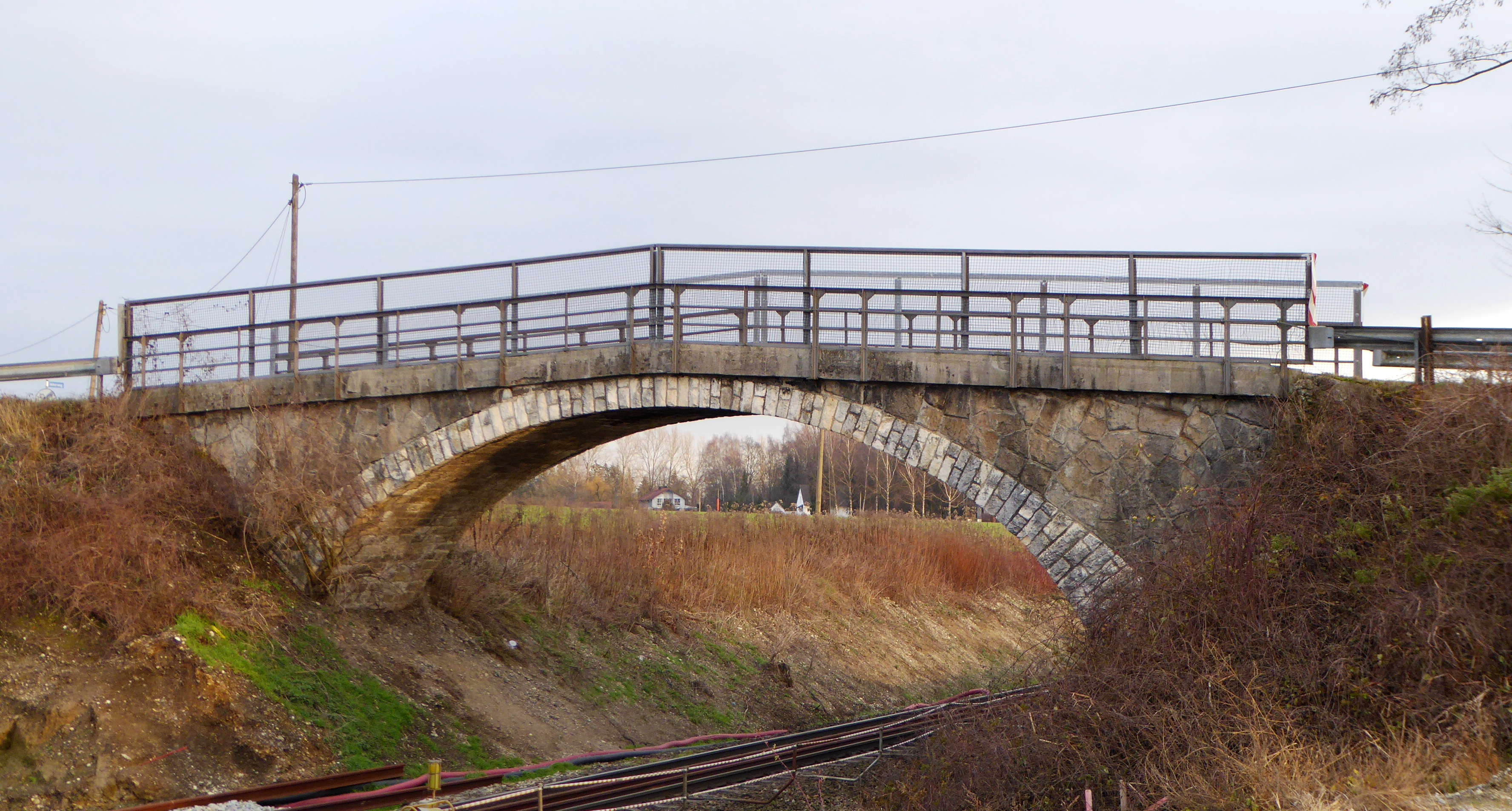
Deutsch: Die Brücke über die Bahn nach Tüßling an der Mitterfeldstraße / Eichkapellenstraße in Mühldorf am Inn, während der Bauarbeiten am zweiten Streckengleis.
Esperanto: Ponto de la vojo Mitterfeldstrasse / Eichkapellenstrasse super la fervojo al Tüssling en Mühldorf am Inn (DE), dum la konstruado de dua trako. |
|||
Date | ||||
Source | Self-photographed | |||
Author | Aisano | |||
Permission (Reusing this file) |
I, the copyright holder of this work, hereby publish it under the following license:
|
Camera location | 48° 14′ 33.2″ N, 12° 33′ 04.8″ E | View this and other nearby images on: OpenStreetMap | 48.242556; 12.551333 |
---|
File history
Click on a date/time to view the file as it appeared at that time.
Date/Time | Thumbnail | Dimensions | User | Comment | |
---|---|---|---|---|---|
current | 20:31, 15 December 2015 | 3,552 × 1,904 (1.99 MB) | Renardo la vulpo (talk | contribs) | {{Information |Description ={{bar|De Bruckn iwa d'Bahn noch Dissling an da Mittafejdschtrass / Oachkapejnschtrass z Mujdoaf, wia's zwoate Gleis baut worn is.}} {{de|1=Die Brücke über die Bahn nach Tüßling an der Mitterfeldstraße / Eichkapellens... |
You cannot overwrite this file.
File usage on Commons
The following 2 pages use this file:
Metadata
This file contains additional information such as Exif metadata which may have been added by the digital camera, scanner, or software program used to create or digitize it. If the file has been modified from its original state, some details such as the timestamp may not fully reflect those of the original file. The timestamp is only as accurate as the clock in the camera, and it may be completely wrong.
Camera manufacturer | Panasonic |
---|---|
Camera model | DMC-TZ61 |
Exposure time | 1/60 sec (0.016666666666667) |
F-number | f/3.9 |
ISO speed rating | 100 |
Date and time of data generation | 15:11, 13 December 2015 |
Lens focal length | 7.8 mm |
Latitude | 48° 14′ 31.54″ N |
Longitude | 12° 33′ 5.51″ E |
Orientation | Normal |
Horizontal resolution | 180 dpi |
Vertical resolution | 180 dpi |
Software used | GIMP 2.8.14 |
File change date and time | 21:25, 15 December 2015 |
Y and C positioning | Co-sited |
Exposure Program | Normal program |
Exif version | 2.3 |
Date and time of digitizing | 15:11, 13 December 2015 |
Meaning of each component |
|
Image compression mode | 2 |
APEX exposure bias | 0 |
Maximum land aperture | 3.9296875 APEX (f/3.9) |
Metering mode | Center weighted average |
Light source | Unknown |
Flash | Flash did not fire, compulsory flash suppression |
Supported Flashpix version | 1 |
Color space | sRGB |
Sensing method | One-chip color area sensor |
File source | Digital still camera |
Scene type | A directly photographed image |
Custom image processing | Normal process |
Exposure mode | Auto exposure |
White balance | Auto white balance |
Digital zoom ratio | 0 |
Focal length in 35 mm film | 44 mm |
Scene capture type | Standard |
Scene control | None |
Contrast | Normal |
Saturation | Normal |
Sharpness | Normal |
GPS time (atomic clock) | 14:10 |
Receiver status | Measurement in progress |
Measurement mode | 2-dimensional measurement |
Measurement precision | Fair (1.1) |
Geodetic survey data used | WGS-84 |
Name of GPS area | Mühldorf am Inn |
GPS date | 13 December 2015 |
GPS tag version | 0.0.3.2 |
Image width | 4,000 px |
Image height | 3,000 px |
Name of GPS processing method | 14 bytes undefined data |