File:München, Straßenschild Bad-Dürkheimer-Straße, 1.jpeg

Size of this preview: 800 × 320 pixels. Other resolutions: 320 × 128 pixels | 640 × 256 pixels | 1,024 × 410 pixels | 1,280 × 512 pixels | 3,600 × 1,440 pixels.
Original file (3,600 × 1,440 pixels, file size: 1.41 MB, MIME type: image/jpeg)
Captions
Captions
Add a one-line explanation of what this file represents
Summary
edit
| Description |
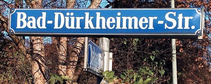
Deutsch: München, Straßenschild Bad-Dürkheimer-Straße [sic]. Der Duden gibt das Beispiel (D145), dass man entweder „Bad-Homburger Weg“ (ein Bindestrich) oder „Bad Homburger Weg“ (kein Bindestrich) schreiben kann. In München werden aber, wie hier, alle Straßennamen mit „Bad“ mit zwei Bindestrichen durchgekoppelt, auch wenn sie die Endung „-er“ verwenden: „Bad-Ischler-Straße“, „Bad-Kreuther-Straße“, „Bad-Kreuznacher-Straße“ usw.
Esperanto: Munkeno (DE), stratnoma ŝildo Bad-Dürkheimer-Straße. La vortaro Duden donas la ekzemplon (D145) „Bad-Homburger Weg“ aŭ „Bad Homburger Weg“, do eblas uzi unu ligostrekon aŭ neniun, sed ne du. En Munkeno tamen ĉiuj stratnomoj kun „Bad“ uzas du ligostrekojn, eĉ se ili uzas la adjektivan finaĵon „-er“: „Bad-Ischler-Straße“, „Bad-Kreuther-Straße“, „Bad-Kreuznacher-Straße“ usw. |
| Date | |
| Source | Self-photographed |
| Author | Renardo la vulpo |
Licensing
edit
I, the copyright holder of this work, hereby publish it under the following license:
| This file is made available under the Creative Commons CC0 1.0 Universal Public Domain Dedication. | |
| The person who associated a work with this deed has dedicated the work to the public domain by waiving all of their rights to the work worldwide under copyright law, including all related and neighboring rights, to the extent allowed by law. You can copy, modify, distribute and perform the work, even for commercial purposes, all without asking permission.
|
File history
Click on a date/time to view the file as it appeared at that time.
| Date/Time | Thumbnail | Dimensions | User | Comment | |
|---|---|---|---|---|---|
| current | 15:16, 27 November 2023 | 3,600 × 1,440 (1.41 MB) | Renardo la vulpo (talk | contribs) | {{Information |Description = {{de|1=München, Straßenschild Bad-Dürkheimer-Straße [sic]. Der Duden gibt das Beispiel (D145), dass man entweder „Bad-Homburger Weg“ (ein Bindestrich) oder „Bad Homburger Weg“ (kein Bindestrich) schreiben kann. In München werden aber, wie hier, alle Straßennamen mit „Bad“ mit zwei Bindestrichen durchgekoppelt, auch wenn sie die Endung „-er“ verwenden: „Bad-Ischler-Straße“, „Bad-Kreuther-Straße“, „Bad-Kreuznacher-Straße“ usw.}} {{eo|1=Munkeno (DE), s... |
You cannot overwrite this file.
File usage on Commons
There are no pages that use this file.