File:MEL Aerial Shot.png

Size of this preview: 600 × 600 pixels. Other resolutions: 240 × 240 pixels | 480 × 480 pixels | 929 × 929 pixels.
Original file (929 × 929 pixels, file size: 1.17 MB, MIME type: image/png)
Captions
Captions
Add a one-line explanation of what this file represents
Summary edit
| Description |
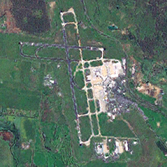
English: Satellite view of Melbourne Airport via NASA World Wind. Runway and terminal layout visible. |
| Date | Captured from World Wind on 28 September 2008 |
| Source | NASA World Wind |
| Author | NASA World Wind |
| Permission (Reusing this file) |
Public domain |
Licensing edit
| This image is in the public domain because it is a screenshot from NASA’s globe software World Wind using a public domain layer, such as Blue Marble, MODIS, Landsat, SRTM, USGS or GLOBE.
|
 |
File history
Click on a date/time to view the file as it appeared at that time.
| Date/Time | Thumbnail | Dimensions | User | Comment | |
|---|---|---|---|---|---|
| current | 09:46, 28 September 2008 | | 929 × 929 (1.17 MB) | Mvjs (talk | contribs) | {{Information |Description={{en|1=Melbourne Airport as viewed from the NASA World Wind Satellite. Runway and terminal layout visible.}} |Source=NASA World Wind |Author=NASA World Wind |Date=Captured from World Wind on 28 September 2008 |Permission= |other |
You cannot overwrite this file.
File usage on Commons
The following page uses this file:
File usage on other wikis
The following other wikis use this file:
- Usage on id.wikipedia.org
- Usage on ko.wikipedia.org
- Usage on no.wikipedia.org
- Usage on ru.wikipedia.org
- Usage on uk.wikipedia.org
- Usage on www.wikidata.org