File:MG 0939 Anklamer Stadtbruch Graureiher1.jpg
![File:MG 0939 Anklamer Stadtbruch Graureiher1.jpg](https://upload.wikimedia.org/wikipedia/commons/thumb/5/55/MG_0939_Anklamer_Stadtbruch_Graureiher1.jpg/800px-MG_0939_Anklamer_Stadtbruch_Graureiher1.jpg?20150526094045)
Original file (2,052 × 1,368 pixels, file size: 745 KB, MIME type: image/jpeg)
Captions
Captions
Summary
editDescriptionMG 0939 Anklamer Stadtbruch Graureiher1.jpg |
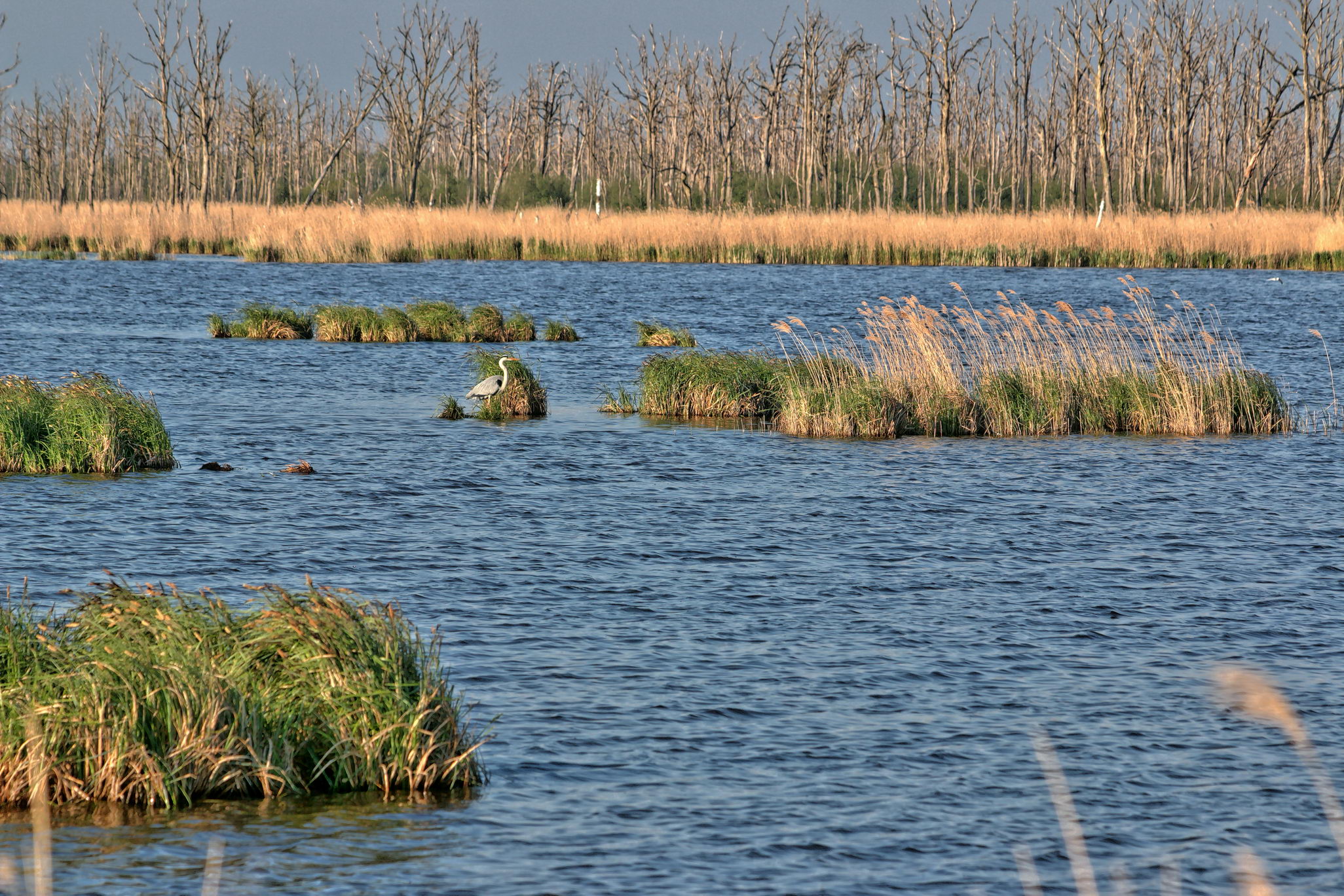
English: abends im Stadtbruch,der Graureiher beobachtete mich und verharrte regungslos.auch nach Ende der Fotosession verließ er seinen Platz nicht.Die Entfernung zu ihm betrug etwa 50-60m. |
Date | |
Source | Own work |
Author | Wolfgang M.Schmidt |
Camera location | 53° 48′ 45.04″ N, 13° 49′ 14.88″ E ![]() ![]() | View this and other nearby images on: OpenStreetMap | ![]() |
---|
Licensing
edit![w:en:Creative Commons](https://upload.wikimedia.org/wikipedia/commons/thumb/7/79/CC_some_rights_reserved.svg/90px-CC_some_rights_reserved.svg.png)
![attribution](https://upload.wikimedia.org/wikipedia/commons/thumb/1/11/Cc-by_new_white.svg/24px-Cc-by_new_white.svg.png)
![share alike](https://upload.wikimedia.org/wikipedia/commons/thumb/d/df/Cc-sa_white.svg/24px-Cc-sa_white.svg.png)
- You are free:
- to share – to copy, distribute and transmit the work
- to remix – to adapt the work
- Under the following conditions:
- attribution – You must give appropriate credit, provide a link to the license, and indicate if changes were made. You may do so in any reasonable manner, but not in any way that suggests the licensor endorses you or your use.
- share alike – If you remix, transform, or build upon the material, you must distribute your contributions under the same or compatible license as the original.
![]() |
This image was uploaded as part of Wiki Loves Earth 2015.
aragonés | العربية | asturianu | azərbaycanca | беларуская (тарашкевіца) | български | বাংলা | brezhoneg | català | čeština | Cymraeg | Deutsch | Ελληνικά | English | español | eesti | euskara | فارسی | français | galego | עברית | hrvatski | հայերեն | Bahasa Indonesia | italiano | 日本語 | ქართული | 한국어 | latviešu | македонски | മലയാളം | मराठी | Bahasa Melayu | norsk bokmål | नेपाली | Nederlands | norsk | polski | português | português do Brasil | русский | sicilianu | shqip | slovenščina | српски / srpski | svenska | ไทย | Türkçe | українська | اردو | 中文 | 中文(台灣) | +/− |
![]() |
File history
Click on a date/time to view the file as it appeared at that time.
Date/Time | Thumbnail | Dimensions | User | Comment | |
---|---|---|---|---|---|
current | 09:40, 26 May 2015 | ![]() | 2,052 × 1,368 (745 KB) | Stromer7 (talk | contribs) | User created page with UploadWizard |
You cannot overwrite this file.
File usage on Commons
The following page uses this file:
Metadata
This file contains additional information such as Exif metadata which may have been added by the digital camera, scanner, or software program used to create or digitize it. If the file has been modified from its original state, some details such as the timestamp may not fully reflect those of the original file. The timestamp is only as accurate as the clock in the camera, and it may be completely wrong.
Camera manufacturer | Canon |
---|---|
Camera model | EOS 70D |
Author | Wolfgang M.Schmidt |
Copyright holder |
|
Exposure time | 1,953/500,000 sec (0.003906) |
F-number | f/8 |
ISO speed rating | 100 |
Date and time of data generation | 18:20, 5 May 2015 |
Lens focal length | 160 mm |
Latitude | 53° 48′ 45.04″ N |
Longitude | 13° 49′ 14.88″ E |
Image title |
|
Short title |
|
Headline | Graureiher beim Fischen |
Orientation | Normal |
Horizontal resolution | 300 dpi |
Vertical resolution | 300 dpi |
Software used | ACDSee Pro 8 |
File change date and time | 14:23, 20 May 2015 |
Y and C positioning | Centered |
Date and time of digitizing | 18:20, 5 May 2015 |
DateTime subseconds | 625 |
GPS time (atomic clock) | 09:06 |
Reference for direction of image | True direction |
Direction of image | 61.19 |
Geodetic survey data used | WGS-84 |
Latitude destination | 53° 48′ 49.14″ N |
Longitude of destination | 13° 49′ 27.5″ E |
GPS date | 13 May 2015 |
GPS tag version | 0.0.2.2 |
Contact information | wms-foto@t-online.de
Baumschulenweg 35 Frankfurt (Oder), , 15236 Deutschland |
Type of item | Landschaft |
Keywords |
|
Writer | Wolfgang M.Schmidt |
Rating (out of 5) | 0 |
Sublocation of city shown | bei Rosenhagen |
Province or state shown | Mecklenburg Vorpommern |
Country shown | Deutschland |