File:MI11 110.svg

Size of this PNG preview of this SVG file: 507 × 303 pixels. Other resolutions: 320 × 191 pixels | 640 × 382 pixels | 1,024 × 612 pixels | 1,280 × 765 pixels | 2,560 × 1,530 pixels.
Original file (SVG file, nominally 507 × 303 pixels, file size: 1.35 MB)
Captions
Captions
Add a one-line explanation of what this file represents
Summary edit
| Description |
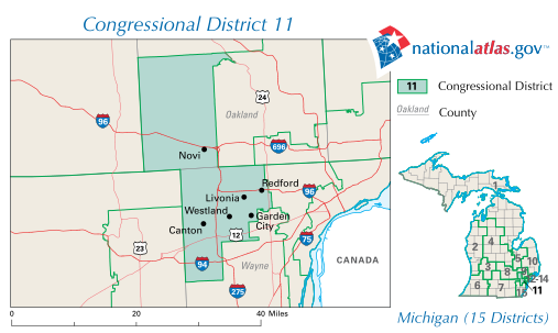
English: Conversion of PDF using Illustrator 14 |
| Date | (note: this map is out-of-date and incomplete) |
| Source | http://nationalatlas.gov/printable/images/pdf/congdist/MI11_110.pdf |
| Author | United States Department of the Interior |
| Other versions | Mi11 109.gif |
Licensing edit
This map was obtained from an edition of the National Atlas of the United States. Like almost all works of the U.S. federal government, works from the National Atlas are in the public domain in the United States.
Online access: NationalAtlas.gov | 1970 print edition: Library of Congress, Perry-Castañeda Library
|
File history
Click on a date/time to view the file as it appeared at that time.
| Date/Time | Thumbnail | Dimensions | User | Comment | |
|---|---|---|---|---|---|
| current | 00:40, 6 July 2010 | | 507 × 303 (1.35 MB) | KelleyCook (talk | contribs) | == Summary == {{Information |Description={{en|1=Conversion of PDF using Illustrator 14}} |Source=http://nationalatlas.gov/printable/images/pdf/congdist/MI11_110.pdf |Author=United States Department of the Interior |Date=2007-05-23 |Permission= |other_vers |
You cannot overwrite this file.
File usage on Commons
The following page uses this file:
File usage on other wikis
The following other wikis use this file:
- Usage on en.wikipedia.org
- Usage on fr.wikipedia.org