File:MINT countries.png
Size of this preview: 800 × 353 pixels. Other resolutions: 320 × 141 pixels | 640 × 282 pixels | 1,425 × 628 pixels.
Original file (1,425 × 628 pixels, file size: 53 KB, MIME type: image/png)
Captions
Captions
Add a one-line explanation of what this file represents
e não sobre MIKT (Q40115539).
Summary edit
| Description |
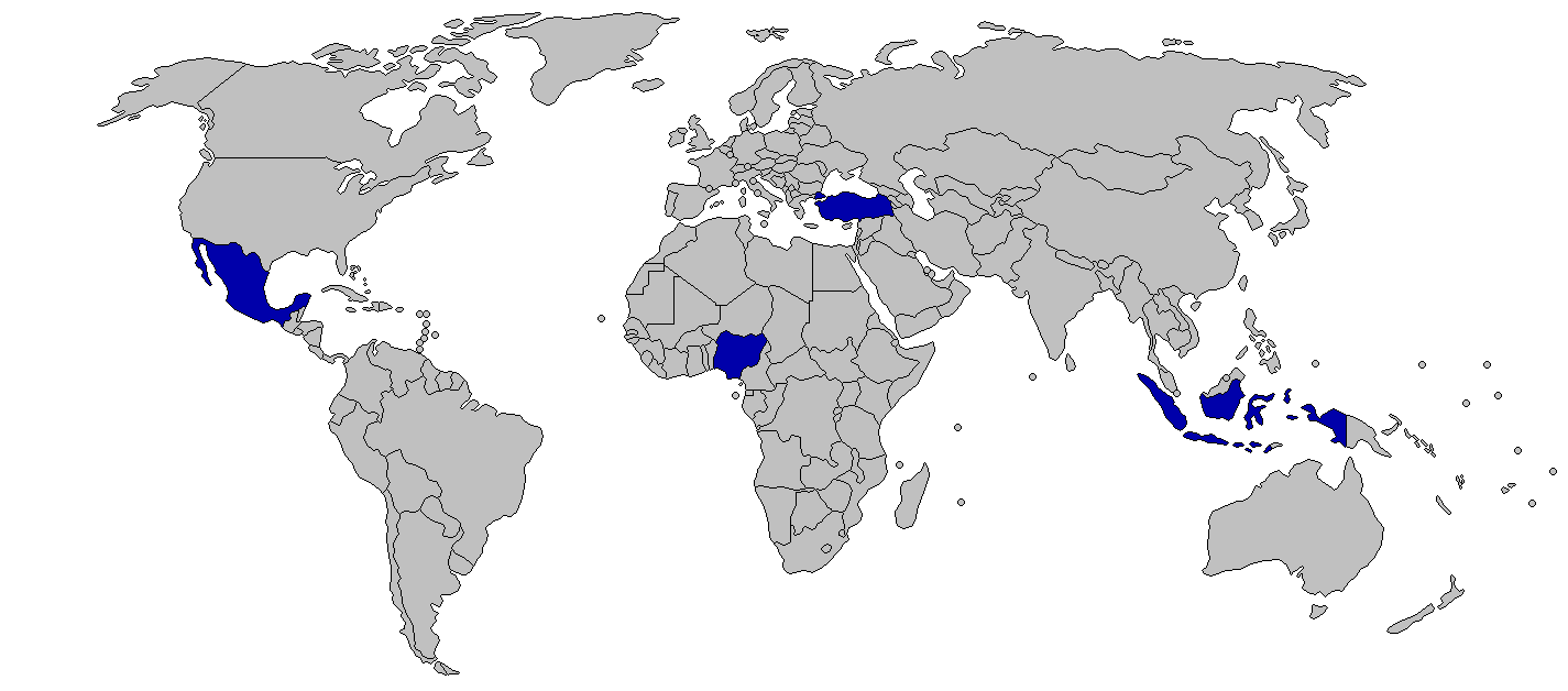
English: MINT
MINT - Mexico, Indonesia, Nigeria, Turkey Português: As Potências regionais. |
||
| Date | 2012-04-19, 2014-06-16 (current) | ||
| Source | Own work | ||
| Author | Kaiserble (talk), Viller the Great (talk) | ||
| Permission (Reusing this file) |
|
||
| Other versions |
|

Licensing edit
I, the copyright holder of this work, hereby publish it under the following license:
This file is licensed under the Creative Commons Attribution-Share Alike 3.0 Unported license.
- You are free:
- to share – to copy, distribute and transmit the work
- to remix – to adapt the work
- Under the following conditions:
- attribution – You must give appropriate credit, provide a link to the license, and indicate if changes were made. You may do so in any reasonable manner, but not in any way that suggests the licensor endorses you or your use.
- share alike – If you remix, transform, or build upon the material, you must distribute your contributions under the same or compatible license as the original.
File history
Click on a date/time to view the file as it appeared at that time.
| Date/Time | Thumbnail | Dimensions | User | Comment | |
|---|---|---|---|---|---|
| current | 08:42, 10 August 2014 | | 1,425 × 628 (53 KB) | Viller the Great (talk | contribs) | Better version |
| 00:47, 28 June 2014 |  | 1,373 × 661 (49 KB) | Viller the Great (talk | contribs) | Reverted to version as of 02:43, 26 May 2014 | |
| 02:17, 17 June 2014 |  | 1,373 × 661 (48 KB) | Viller the Great (talk | contribs) | This map will include Australia, another one will be made. | |
| 02:43, 26 May 2014 |  | 1,373 × 661 (49 KB) | Viller the Great (talk | contribs) | Reverted to version as of 04:02, 22 November 2013 | |
| 03:29, 25 April 2014 |  | 1,373 × 661 (48 KB) | Viller the Great (talk | contribs) | Better version, also including Australia | |
| 05:23, 2 January 2014 |  | 1,373 × 661 (49 KB) | Viller the Great (talk | contribs) | Corrected map to the MIST, with Nigeria being possibly included | |
| 04:02, 22 November 2013 |  | 1,373 × 661 (49 KB) | Viller the Great (talk | contribs) | The new list is knowns as the MINTs, sometimes adding an "S" for South Korea. | |
| 13:35, 19 April 2012 |  | 1,373 × 661 (54 KB) | Kaiserble (talk | contribs) |
You cannot overwrite this file.
File usage on Commons
The following page uses this file:
- File:MIKT.png (file redirect)
File usage on other wikis
The following other wikis use this file:
- Usage on de.wikipedia.org
- Usage on fa.wikipedia.org
- Usage on fi.wikipedia.org
- Usage on ha.wikipedia.org
- Usage on hy.wikipedia.org
- Usage on ru.wikipedia.org
- Usage on tr.wikipedia.org
- Usage on www.wikidata.org