File:MT-Arata Station-AP1947.jpg

Size of this preview: 667 × 599 pixels. Other resolutions: 267 × 240 pixels | 534 × 480 pixels | 855 × 768 pixels | 1,140 × 1,024 pixels | 1,307 × 1,174 pixels.
Original file (1,307 × 1,174 pixels, file size: 1.25 MB, MIME type: image/jpeg)
Captions
Captions
Add a one-line explanation of what this file represents
Summary
edit| Description |
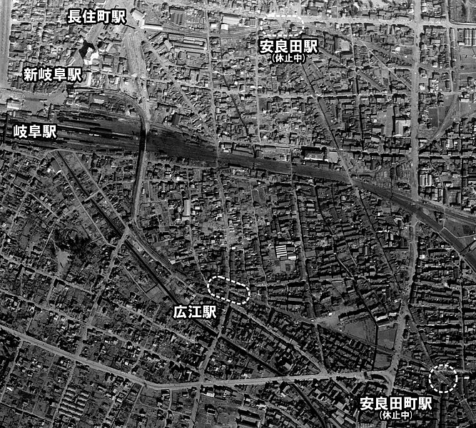
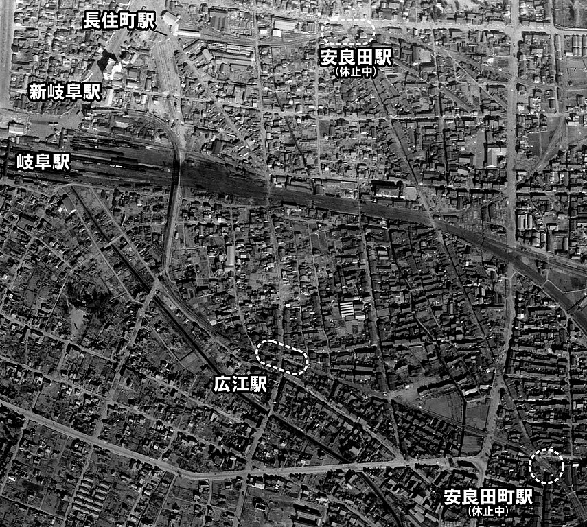
English: Nagoya Railroad Arata Station and Arata-machi Station. 日本語: 名古屋鉄道 安良田駅と安良田町駅の位置関係 |
| Date | |
| Source |
|
| Author |
Licensing
edit
|
The copyright holder of this file, Ministry of Land, Infrastructure, Transport and Tourism, allows anyone to use it for any purpose, provided that the copyright holder is properly attributed. Redistribution, derivative work, commercial use, and all other use is permitted. |
Attribution:
National Land Image Information (Color Aerial Photographs), created by Ministry of Land, Infrastructure, Transport and Tourism, distributed by Geospatial Information Authority of Japan
|

File history
Click on a date/time to view the file as it appeared at that time.
| Date/Time | Thumbnail | Dimensions | User | Comment | |
|---|---|---|---|---|---|
| current | 18:03, 10 February 2020 | | 1,307 × 1,174 (1.25 MB) | ButuCC (talk | contribs) | {{Information |description={{en|1=Nagoya Railroad Arata Station and Arata-machi Station.}}{{ja|1=名古屋鉄道 安良田駅と安良田町駅の位置関係}} |date=1947-11-19 |source= *国土交通省「国土画像情報(カラー空中写真)」(配布元:国土地理院地図・空中写真閲覧サービス) **[https://mapps.gsi.go.jp/maplibSearch.do?specificationId=235631 整理番号 R567-No1-175] |author={{ja|国土地理院、ButuCCが加工。}} {{en|Geospatial Information Authority of Japan, modified by ButuCC}} |permission= |other... |
You cannot overwrite this file.
File usage on Commons
The following 3 pages use this file:
File usage on other wikis
The following other wikis use this file: