File:MadleySateliteEarthStation(PhilipHalling)Apr2006.jpg

Size of this preview: 800 × 533 pixels. Other resolutions: 320 × 213 pixels | 640 × 426 pixels | 1,024 × 682 pixels | 1,280 × 852 pixels | 2,560 × 1,704 pixels.
Original file (2,560 × 1,704 pixels, file size: 1.27 MB, MIME type: image/jpeg)
Captions
Captions
Add a one-line explanation of what this file represents
| Description |
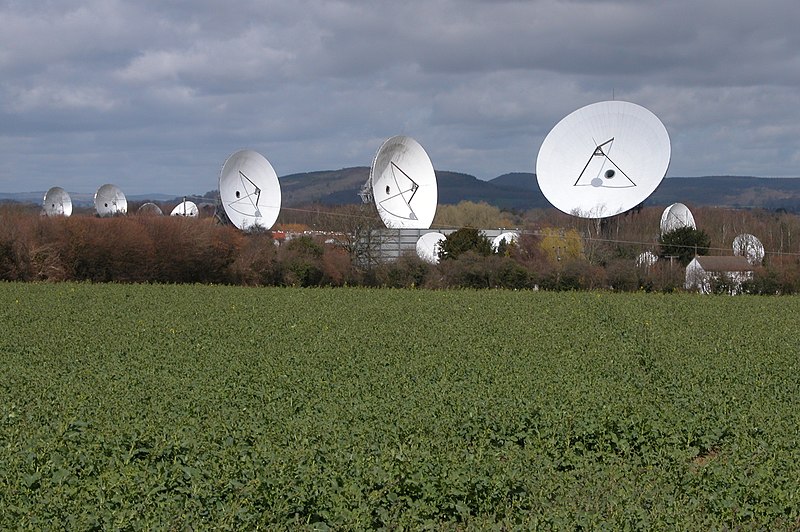
English: Madley Communications Centre earth satellite tracking station, Herefordshire, England |
| Date | |
| Source | From geograph.org.uk |
| Author | Philip Halling |
| Permission (Reusing this file) |
Creative Commons Attribution Share-alike license 2.0 |
| Camera location | | View this and other nearby images on: OpenStreetMap |
|---|
Apr2006.jpg¶ms=052.024400_N_-002.836000_E_globe:Earth_type:camera_source:geograph-osgb36(SO427365)_heading:337.00&language=en)
| Object location | | View this and other nearby images on: OpenStreetMap |
|---|
Apr2006.jpg¶ms=052.028840_N_-002.837500_E_globe:Earth_class:object_type:object_source:geograph-osgb36(SO42633704)_heading:337.00&language=en)

|
This image was taken from the Geograph project collection. See this photograph's page on the Geograph website for the photographer's contact details. The copyright on this image is owned by Philip Halling and is licensed for reuse under the Creative Commons Attribution-ShareAlike 2.0 license.
|
This file is licensed under the Creative Commons Attribution-Share Alike 2.0 Generic license.
Attribution: Philip Halling
- You are free:
- to share – to copy, distribute and transmit the work
- to remix – to adapt the work
- Under the following conditions:
- attribution – You must give appropriate credit, provide a link to the license, and indicate if changes were made. You may do so in any reasonable manner, but not in any way that suggests the licensor endorses you or your use.
- share alike – If you remix, transform, or build upon the material, you must distribute your contributions under the same or compatible license as the original.
Original upload log edit
Apr2006.jpg&action=edit§ion=1)
The original description page was here. All following user names refer to en.wikipedia.
- 2006-09-10 20:20 Euchiasmus 640×426×??? (111011 bytes) Picture of Madley Communications Centre earth satellite tracking station, Herefordshire, England, taken by Philip Halling in 2006 and placed on the geograph website under a Creative Commons License. Image can be seen at https://www.geograph.org.uk/photo/15
File history
Click on a date/time to view the file as it appeared at that time.
| Date/Time | Thumbnail | Dimensions | User | Comment | |
|---|---|---|---|---|---|
| current | 20:46, 24 August 2017 | | 2,560 × 1,704 (1.27 MB) | Geograph Update Bot (talk | contribs) | Higher-resolution version from Geograph. |
| 16:04, 20 September 2008 |  | 640 × 426 (108 KB) | Angusmclellan (talk | contribs) | {{Information |Description={{en|Madley Communications Centre earth satellite tracking station, Herefordshire, England}} |Source=From [http://www.geograph.org.uk/photo/150866 geograph.org.uk] |Date=2006-04-08 |Author=[http://www.geograph.org.uk/profile/183 |
You cannot overwrite this file.
File usage on Commons
The following 2 pages use this file:
File usage on other wikis
The following other wikis use this file:
- Usage on cy.wikipedia.org
- Usage on de.wikipedia.org
- Usage on en.wikipedia.org
- Usage on www.wikidata.org
Apr2006.jpg&oldid=716962043)