File:Mali Gao.png
No higher resolution available.
Mali_Gao.png (449 × 443 pixels, file size: 5 KB, MIME type: image/png)
Captions
Captions
Add a one-line explanation of what this file represents
Summary edit
| Description |
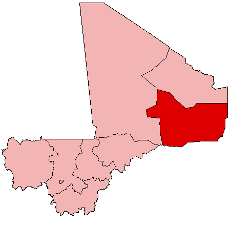
English: Map of Mali showing Gao Region; created with the GIMP. Made by User:Acntx. |
| Date | 31 July 2005 (original upload date) |
| Source | Own work |
| Author | Acntx at English Wikipedia |
Licensing edit
Acntx at English Wikipedia, the copyright holder of this work, hereby publishes it under the following license:
| This file is licensed under the Creative Commons Attribution-Share Alike 3.0 Unported license. Subject to disclaimers. | ||
| Attribution: Acntx at English Wikipedia | ||
| ||
| This licensing tag was added to this file as part of the GFDL licensing update. |

|
Permission is granted to copy, distribute and/or modify this document under the terms of the GNU Free Documentation License, Version 1.2 or any later version published by the Free Software Foundation; with no Invariant Sections, no Front-Cover Texts, and no Back-Cover Texts. A copy of the license is included in the section entitled GNU Free Documentation License. Subject to disclaimers. |
Original upload log edit
The original description page was here. All following user names refer to en.wikipedia.
- 2005-07-31 21:18 Acntx 449×443 (5341 bytes)
File history
Click on a date/time to view the file as it appeared at that time.
| Date/Time | Thumbnail | Dimensions | User | Comment | |
|---|---|---|---|---|---|
| current | 19:56, 12 July 2012 | | 449 × 443 (5 KB) | MGA73bot2 (talk | contribs) | {{BotMoveToCommons|en.wikipedia|year={{subst:CURRENTYEAR}}|month={{subst:CURRENTMONTHNAME}}|day={{subst:CURRENTDAY}}}} == {{int:filedesc}} == {{Information |description={{en|1=Map of Mali showing Gao Region; created with the GIMP. Made by [[:en:User:A... |
You cannot overwrite this file.
File usage on Commons
There are no pages that use this file.
File usage on other wikis
The following other wikis use this file:
- Usage on en.wikipedia.org
- Gao
- Gao Region
- La Dune Rose
- Bakal, Gao Region
- Bamba, Gao Region
- Bourem
- Labbezenga
- Gao International Airport
- Ansongo
- Wikipedia:WikiProject Mali/Regional commune templates
- Template:Communes of the Gao Region
- Ansongo Cercle
- Bourem Cercle
- Gao Cercle
- Koïma
- Template:Gao-geo-stub
- Bara, Gao Region
- Ouattagouna
- Talataye
- Tessit
- Tin-Hama
- Temera, Gao Region
- Tarkint
- Taboye
- Bourra
- Anchawadi
- Gabero
- Gounzoureye
- N'Tillit
- Sony Aliber
- Tilemsi, Gao
- Djebock
- Haoussa Foulane
- Wabaria
- Forgo Sourhai
- Tine Aouker
- Tassiga
- Category:Populated places in Gao Region
- User:Cobblet/Watched pages
- Usage on simple.wikipedia.org
- Usage on uz.wikipedia.org
- Usage on www.wikidata.org
- Usage on zh.wikipedia.org
View more global usage of this file.