File:Map-Francophonie Europe-fr.svg

Size of this PNG preview of this SVG file: 500 × 300 pixels. Other resolutions: 320 × 192 pixels | 640 × 384 pixels | 1,024 × 614 pixels | 1,280 × 768 pixels | 2,560 × 1,536 pixels.
Original file (SVG file, nominally 500 × 300 pixels, file size: 547 KB)
Captions
Captions
Add a one-line explanation of what this file represents
| Description |
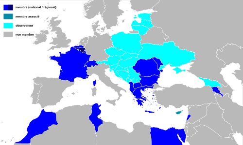
Français : Carte de la francophonie en Europe (oct 2008)
English: Map of francophony organization in Europe |
| Date | |
| Source | Zoom sur la mise à jour de Image:Map-Francophonie organisation 2005.png (Yug) sur le fond Image:BlankMap-World6, compact.svg (domaine public) |
| Author | User:Bourrichon |
| Other versions |
|


|
This SVG file contains embedded text that can be translated into your language, using any capable SVG editor, text editor or the SVG Translate tool. For more information see: About translating SVG files. |
This W3C-unspecified vector image was created with Inkscape .
| I, the copyright holder of this work, release this work into the public domain. This applies worldwide. In some countries this may not be legally possible; if so: I grant anyone the right to use this work for any purpose, without any conditions, unless such conditions are required by law. |
File history
Click on a date/time to view the file as it appeared at that time.
| Date/Time | Thumbnail | Dimensions | User | Comment | |
|---|---|---|---|---|---|
| current | 17:49, 30 November 2014 | | 500 × 300 (547 KB) | Kyat02 (talk | contribs) | add Kosovo |
| 16:29, 21 October 2014 |  | 500 × 300 (547 KB) | Kyat02 (talk | contribs) | Arménie membre | |
| 23:10, 9 February 2014 |  | 500 × 300 (547 KB) | Kyat02 (talk | contribs) | Modification : l'Arménie est toujours membre associé | |
| 10:02, 14 October 2012 |  | 500 × 300 (547 KB) | Augusta 89 (talk | contribs) | Mise à jour pour l'Arménie | |
| 15:42, 24 October 2010 |  | 500 × 300 (547 KB) | Kyat02 (talk | contribs) | {{Information |Description= mise à jour 2010 |Source= OIF |Date= 24/10/2010 |Author= kyat02 |Permission= free |other_versions= }} | |
| 22:25, 20 March 2010 |  | 500 × 300 (547 KB) | Kyat02 (talk | contribs) | {{Information |Description= Map francophonie Europe 2010 |Source= own work |Date= 20/03/2010 |Author= kyat02 |Permission= free licence |other_versions= }} | |
| 00:54, 2 November 2008 |  | 500 × 300 (542 KB) | Bourrichon (talk | contribs) | {{Information |Description= {{fr|Les états appartenant à l'OIF en 2008}} {{en|The Organisation internationale de la francophonie's states.}} |S | |
| 21:12, 25 October 2008 |  | 500 × 300 (542 KB) | Bourrichon (talk | contribs) | == Summary == {{Information |Description=fr : Carte de la francophonie en Europe (oct 2008) / en : Map of francophony organization in Europe |Source=Zoom sur la mise à jour de Image:Map-Francophonie organisation 2005.png (Yug) sur le fond [[:Image:B |
You cannot overwrite this file.
File usage on Commons
The following page uses this file:
File usage on other wikis
The following other wikis use this file:
- Usage on diq.wikipedia.org
- Usage on eo.wikipedia.org
- Usage on fr.wikipedia.org
- Usage on hy.wikipedia.org
- Usage on ka.wikipedia.org