File:Map 1777 Burke County, NC.jpg
Size of this preview: 776 × 600 pixels. Other resolutions: 311 × 240 pixels | 621 × 480 pixels | 994 × 768 pixels | 1,280 × 989 pixels | 1,584 × 1,224 pixels.
Original file (1,584 × 1,224 pixels, file size: 210 KB, MIME type: image/jpeg)
Captions
Captions
1777 Boundaries Burke Co. NC
Summary edit
| Description |
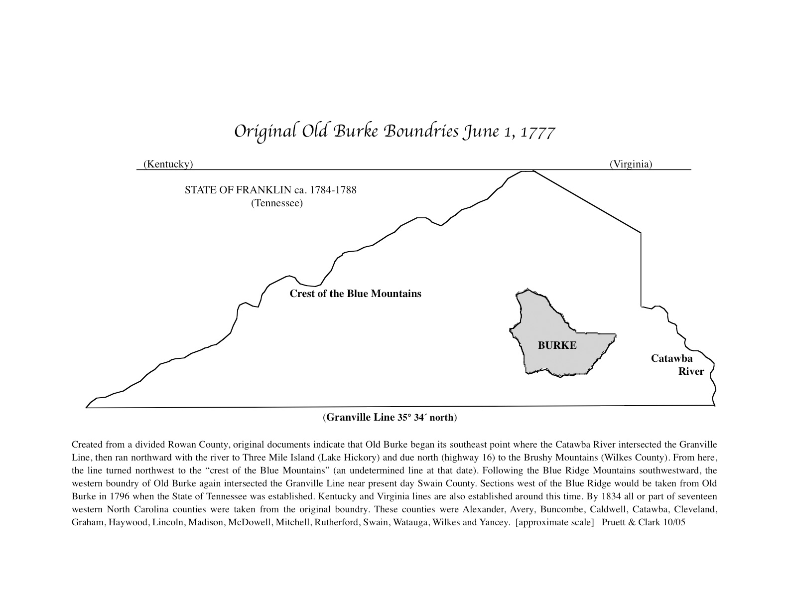
English: Created June 1, 1777, from Rowan County along the Granville line to the crest of the Blue Mountains. By 1834 all or part of seventeen western counties were taken from its original boundaries. The "State of Franklin" depicted was an illegal attempt by over the mountain settlers to join the U.S. with John Sevier as its "governor." |
| Date | |
| Source | Own work |
| Author | Clarklarry |
Licensing edit
I, the copyright holder of this work, hereby publish it under the following license:
This file is licensed under the Creative Commons Attribution-Share Alike 4.0 International license.
- You are free:
- to share – to copy, distribute and transmit the work
- to remix – to adapt the work
- Under the following conditions:
- attribution – You must give appropriate credit, provide a link to the license, and indicate if changes were made. You may do so in any reasonable manner, but not in any way that suggests the licensor endorses you or your use.
- share alike – If you remix, transform, or build upon the material, you must distribute your contributions under the same or compatible license as the original.
File history
Click on a date/time to view the file as it appeared at that time.
| Date/Time | Thumbnail | Dimensions | User | Comment | |
|---|---|---|---|---|---|
| current | 22:32, 14 January 2019 | | 1,584 × 1,224 (210 KB) | Clarklarry (talk | contribs) | User created page with UploadWizard |
You cannot overwrite this file.
File usage on Commons
There are no pages that use this file.