File:Map Clervaux.png
No higher resolution available.
Map_Clervaux.png (203 × 270 pixels, file size: 7 KB, MIME type: image/png)
Captions
Captions
Add a one-line explanation of what this file represents
Summary edit
| Description |
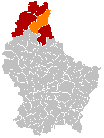
English: Clervaux municipality location after merging of municipalities (valid from 1 January 2012) |
| Date | |
| Source |
English: Own edit of File:Map Clervaux.PNG |
| Author | Les Meloures |
Licensing edit
| I, the copyright holder of this work, release this work into the public domain. This applies worldwide. In some countries this may not be legally possible; if so: I grant anyone the right to use this work for any purpose, without any conditions, unless such conditions are required by law. |
File history
Click on a date/time to view the file as it appeared at that time.
| Date/Time | Thumbnail | Dimensions | User | Comment | |
|---|---|---|---|---|---|
| current | 17:48, 8 January 2018 | | 203 × 270 (7 KB) | NordNordWest (talk | contribs) | corr |
| 17:27, 8 January 2018 |  | 203 × 270 (5 KB) | NordNordWest (talk | contribs) | upd | |
| 20:57, 10 November 2015 |  | 203 × 270 (5 KB) | NordNordWest (talk | contribs) | no more districts in Luxembourg | |
| 18:52, 27 October 2011 |  | 203 × 270 (3 KB) | Les Meloures (talk | contribs) | New map after changes in municipalities in Luxembourg | |
| 18:40, 27 October 2011 |  | 203 × 270 (3 KB) | Les Meloures (talk | contribs) | {{Information |Description ={{en|1=Location Clervaux after changes of municipalities}} |Source ={{own}} |Author =Les Meloures |Date =2011-11-24 |Permission = |other_versions = }} |
You cannot overwrite this file.
File usage on Commons
The following 2 pages use this file:
File usage on other wikis
The following other wikis use this file:
- Usage on als.wikipedia.org
- Usage on ca.wikipedia.org
- Usage on ceb.wikipedia.org
- Usage on de.wikipedia.org
- Usage on frr.wikipedia.org
- Usage on fr.wikipedia.org
- Usage on it.wikipedia.org
- Usage on lb.wikipedia.org
- Usage on li.wikipedia.org
- Usage on nl.wikipedia.org
- Usage on no.wikipedia.org
- Usage on simple.wikipedia.org
- Usage on sk.wikipedia.org
- Usage on sv.wikipedia.org
- Usage on zh.wikipedia.org