File:Map Historical organization of the territory 1992 - Organizzazione storica del valdarno aretino - Touring Club Italiano CART-TEM-094 (cropped).jpg
Size of this preview: 800 × 505 pixels. Other resolutions: 320 × 202 pixels | 640 × 404 pixels | 1,054 × 665 pixels.
Original file (1,054 × 665 pixels, file size: 867 KB, MIME type: image/jpeg)
Captions
Captions
Add a one-line explanation of what this file represents
Summary
edit| Title |
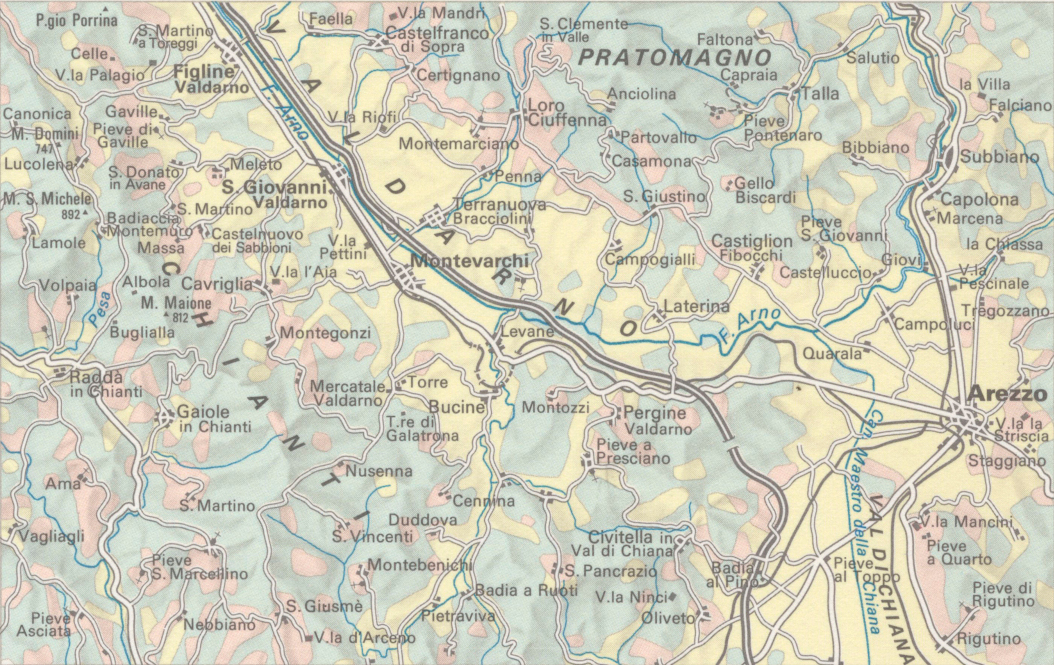
Historical organization of the territory |
|
| Description |
English: The table focuses on the historical organization of the territory (cities, villages, viability…). The table is part of the Tematic Atlas realized by the TCI Cartographic Office with CNR - Italian National Research Council (1989-1992) Italiano: La tavola è incentrata sull'organizzazione storica del territorio (città, villaggi, viabilità..). La tavola fa parte dall'Ufficio Cartografico del TCI con il CNR - Consiglio Nazionale delle Ricerche (1989-1992) |
|
| Map legend |
Italiano: 4. Valdarno aretino: numerosi villaggi di altura testimoni di insediamenti feudali sui rilievi di Pratomagno e del Chianti. Nell'interposta valle si mescolano eredità ubicative etrusche, notevoli impianti urbanistici di fondazione comunale e, soprattutto ove ha inizio la val di Chiana, forti segni degli assetti conseguenti a bonifiche rinascimentali. |
|
| Date | ||
| Source | Scan from the original work Archivio Storico del Touring Club Italiano | |
| Creator |
TCI Cartographic Office |
|
| Permission (Reusing this file) |
|
|
| Geotemporal data | ||
| Map location | Italy | |
| Map type | Urban planning maps of Italy | |
| Scale | 1: 4 000 000; 1: 400 000 | |
| Georeferencing | If inappropriate please set warp_status = skip to hide. | |
| Bibliographic data | ||
| Part of the series | Thematic Atlas of Italy | |
| Language | Italian | |
| Place of publication | Milan | |
| Publisher |
TCI |
|
| Printed by |
TCI |
|
| Archival data | ||
| Collection | ||
| Accession number |
CART.TEM.094 |
|
| Other versions | ||


.jpg&action=edit§ion=1)
Licensing
edit.jpg&action=edit§ion=2)
File history
Click on a date/time to view the file as it appeared at that time.
| Date/Time | Thumbnail | Dimensions | User | Comment | |
|---|---|---|---|---|---|
| current | 11:05, 10 January 2023 | | 1,054 × 665 (867 KB) | Marco Chemello (WMIT) (talk | contribs) | Cropped 1 % horizontally, 13 % vertically using CropTool with precise mode. |
| 15:00, 18 November 2022 |  | 1,069 × 762 (932 KB) | Marta Arosio (WMIT) (talk | contribs) | File:Map Historical organization of the territory 1992 - Touring Club Italiano CART-TEM-094.jpg cropped 79 % horizontally, 78 % vertically using CropTool with lossless mode. |
You cannot overwrite this file.
File usage on Commons
The following 2 pages use this file:
File usage on other wikis
The following other wikis use this file:
- Usage on it.wikipedia.org
.jpg&oldid=903463975)