File:Map ITESM campuses by city.svg

Size of this PNG preview of this SVG file: 800 × 537 pixels. Other resolutions: 320 × 215 pixels | 640 × 429 pixels | 1,024 × 687 pixels | 1,280 × 859 pixels | 2,560 × 1,717 pixels | 975 × 654 pixels.
Original file (SVG file, nominally 975 × 654 pixels, file size: 524 KB)
Captions
Captions
Add a one-line explanation of what this file represents
| Description |
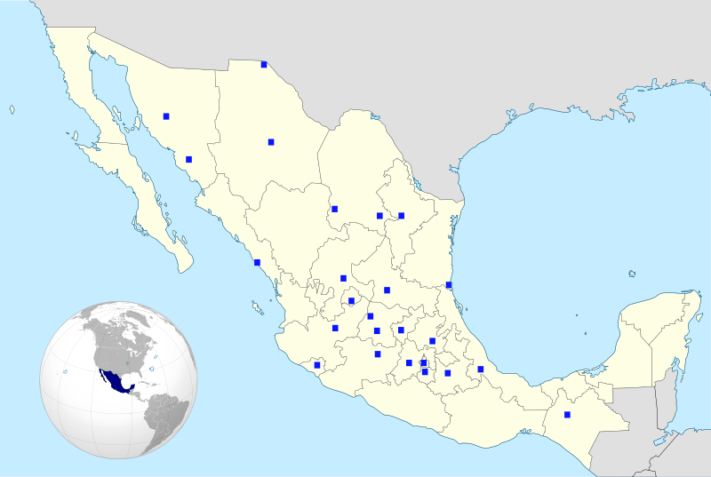
English: The cities where the campuses of the Monterrey Institute of Technology are located are marked in blue in this map of Mexico showing its political divisions.
Español: Mapa con la división política de México mostrando las ciudades donde se ubican los campus del Tecnológico de Monterrey.
Français : Carte de la division politique du Méxique en montrant des villes oú les campus sont |
| Date | (UTC) |
| Source | |
| Author |
|
| Permission (Reusing this file) |
This file is licensed under the Creative Commons Attribution-Share Alike 3.0 Unported license.
|
.svg)
| This is a retouched picture, which means that it has been digitally altered from its original version. Modifications: Maps mixed together; cities and country marked in blue.. The original can be viewed here: Mexico States blank map.svg:
|
W3C-validity not checked.
Original upload log edit
This image is a derivative work of the following images:
- File:Mexico_(orthographic_projection).svg licensed with Cc-by-3.0, GFDL-GMT
- 2008-10-21T21:06:15Z Ssolbergj 541x541 (384533 Bytes) {{Information |Description={{en|1=aefv}} |Source=eav |Author=aedfv |Date=aerv |Permission=eaw |other_versions=ear }} werv [[Category:Maps of Mexico]]
- File:Mexico_States_blank_map.svg licensed with Cc-by-sa-3.0,2.5,2.0,1.0, GFDL
- 2009-05-25T11:58:07Z Sémhur 975x654 (369458 Bytes) Modify border south between Quintana Roo and Campeche
- 2009-05-24T08:31:40Z Sémhur 975x654 (369191 Bytes) Adding Yucatan states
- 2008-09-24T12:57:13Z Sémhur 975x654 (337956 Bytes) new try
- 2008-09-24T12:40:07Z Sémhur 975x654 (335678 Bytes) Thiner strokes
- 2008-09-24T12:37:33Z Sémhur 975x654 (335680 Bytes) {{Information |Description= {{en|Map of Mexico, with states borders.}} {{es|Mapa de Mexico, con los límites de los estados.}} {{fr|Carte du Mexique, avec les limites des états.}} |Source=Travail personnel / Own work. Source
Uploaded with derivativeFX
File history
Click on a date/time to view the file as it appeared at that time.
| Date/Time | Thumbnail | Dimensions | User | Comment | |
|---|---|---|---|---|---|
| current | 20:22, 12 July 2009 | | 975 × 654 (524 KB) | José Gnudista (talk | contribs) | {{Information |Description={{en|The cities where the campuses of the Monterrey Institute of Technology are located are marked in blue in this map of Mexico showing with states borders.}} {{e |
You cannot overwrite this file.
File usage on Commons
There are no pages that use this file.
File usage on other wikis
The following other wikis use this file:
- Usage on ar.wikipedia.org
- Usage on en.wikipedia.org
- Usage on eo.wikipedia.org
- Usage on fr.wikipedia.org
- Usage on pt.wikipedia.org
- Usage on ru.wikipedia.org