File:Map Istrian railway.png
Size of this preview: 602 × 600 pixels. Other resolutions: 241 × 240 pixels | 482 × 480 pixels | 771 × 768 pixels | 1,024 × 1,020 pixels.
Original file (1,024 × 1,020 pixels, file size: 235 KB, MIME type: image/png)
Captions
Captions
Add a one-line explanation of what this file represents
Summary
edit| Description |
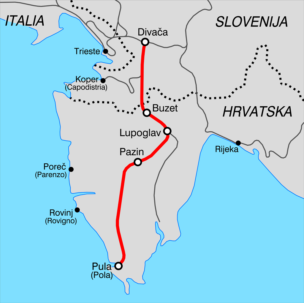
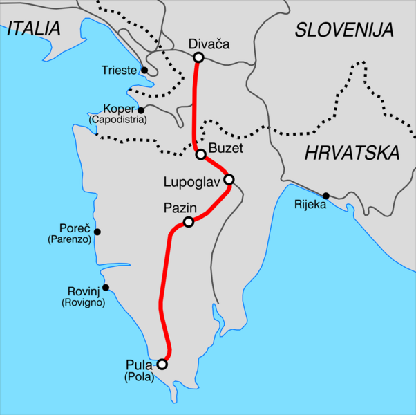
Italiano: Mappa della ferrovia istriana. |
||
| Source | Own work | ||
| Author | Arbalete | ||
| Permission (Reusing this file) |
I, the copyright holder of this work, hereby publish it under the following licenses: This file is licensed under the Creative Commons Attribution-Share Alike 3.0 Unported license.
You may select the license of your choice. |

File history
Click on a date/time to view the file as it appeared at that time.
| Date/Time | Thumbnail | Dimensions | User | Comment | |
|---|---|---|---|---|---|
| current | 16:03, 28 April 2011 | | 1,024 × 1,020 (235 KB) | Arbalete (talk | contribs) | {{Information |Description ={{it|1=Mappa della ferrovia Istriana}} |Source ={{own}} |Author =Friedrichstrasse |Date =2011-04 |Permission = |other_versions = }} Category:Istrian railway [[Cate |
You cannot overwrite this file.
File usage on Commons
There are no pages that use this file.
File usage on other wikis
The following other wikis use this file:
- Usage on cs.wikipedia.org
- Usage on hr.wikipedia.org
- Usage on sl.wikipedia.org
- Usage on sv.wikipedia.org
- Usage on www.wikidata.org