File:Map Kingdom Arelat AR.png

Size of this preview: 587 × 600 pixels. Other resolutions: 235 × 240 pixels | 470 × 480 pixels | 752 × 768 pixels | 1,003 × 1,024 pixels | 1,454 × 1,485 pixels.
Original file (1,454 × 1,485 pixels, file size: 856 KB, MIME type: image/png)
Captions
Captions
Add a one-line explanation of what this file represents
Summary
edit| Description |
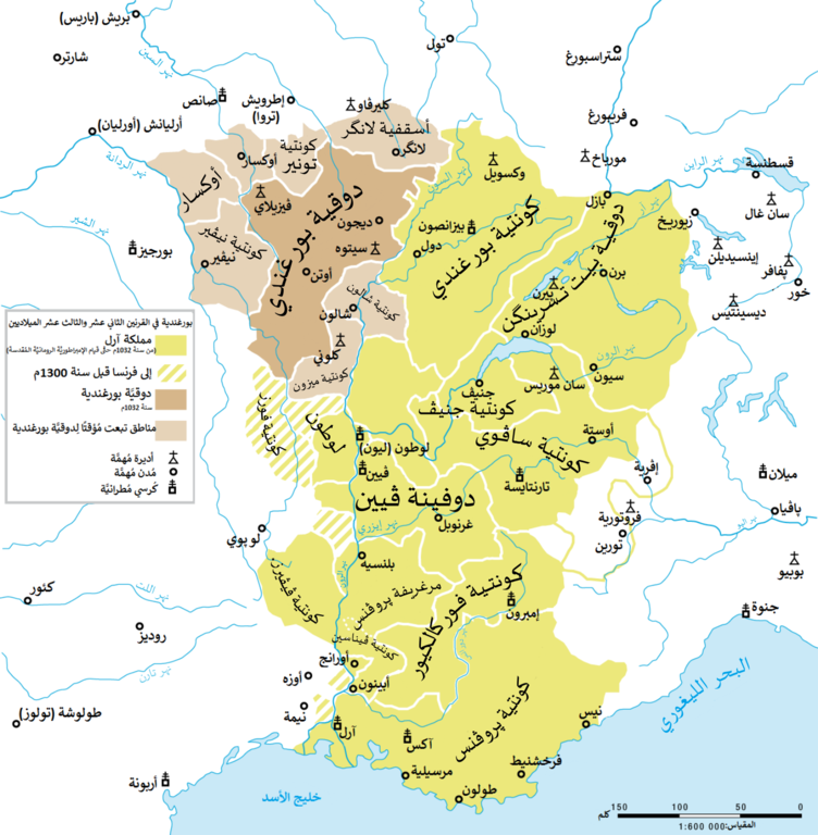
العربية: مملكة آرل ودوقيَّة بورغندية القبطانيَّة في القرنين الثاني عشر والثالث عشر الميلاديين. |
| Date | |
| Source |
This file was derived from: Map Kingdom Arelat EN.png |
| Author | |
| Other versions |
|


| This is a retouched picture, which means that it has been digitally altered from its original version. Modifications: Translated to Arabic - عُرِبَت. The original can be viewed here: Map Kingdom Arelat EN.png:
|
Licensing
edit
You may use my work outside wikipedia for free as long as you name me as the author. If you would like to use my work in a print medium, please send me a specimen copy.
Contact me if you have questions regarding the license or if you want individual changes to the map (marco.zanoli at hotmail.ch). This file is licensed under the Creative Commons Attribution-Share Alike 4.0 International license. Attribution: Marco Zanoli
|
File history
Click on a date/time to view the file as it appeared at that time.
| Date/Time | Thumbnail | Dimensions | User | Comment | |
|---|---|---|---|---|---|
| current | 19:40, 30 September 2017 | | 1,454 × 1,485 (856 KB) | باسم (talk | contribs) | User created page with UploadWizard |
You cannot overwrite this file.
File usage on Commons
The following page uses this file:
File usage on other wikis
The following other wikis use this file:
- Usage on ar.wikipedia.org