File:Map Klias Wetlands.png
Size of this preview: 600 × 600 pixels. Other resolutions: 240 × 240 pixels | 480 × 480 pixels | 1,000 × 1,000 pixels.
Original file (1,000 × 1,000 pixels, file size: 287 KB, MIME type: image/png)
Captions
Captions
Add a one-line explanation of what this file represents
Summary
edit| Description |
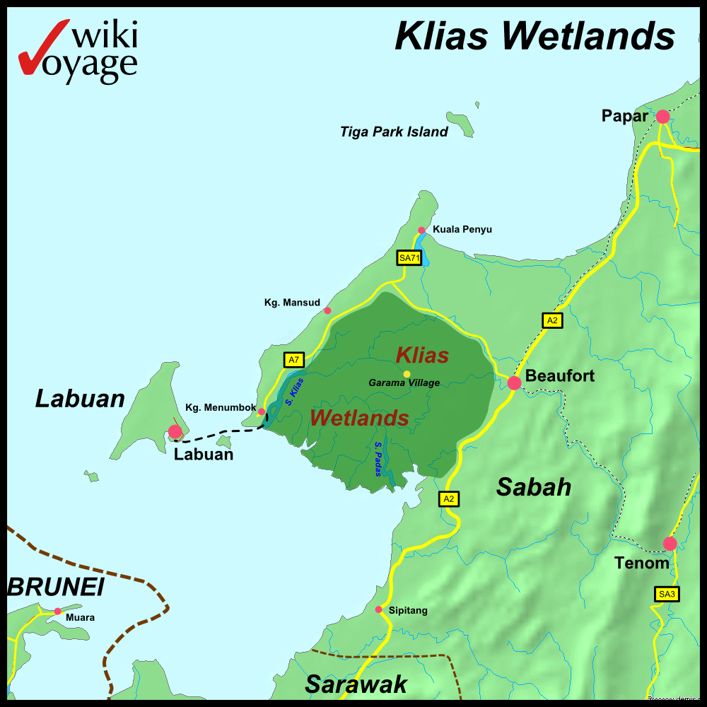
Deutsch: Karte der Klias Wetlands
English: Map of the Klias Wetlands |
|||||||||||||||||
| Date | ||||||||||||||||||
| Source |
Own work - self drawn map own work based on data from Demis.nl |
|||||||||||||||||
| Author |
|
|||||||||||||||||

Licensing
edit
This image is in the public domain because it came from the site https://www.demis.nl/products/web-map-server/examples/ and was released by the copyright holder. Permission is granted to copy, distribute and/or modify this map since it is based on free of copyright images from: www.demis.nl. See also approval email on de.wp and its clarification.
|
| This work has been released into the public domain by its copyright holder, www.demis.nl. This applies worldwide. In some countries this may not be legally possible; if so: www.demis.nl grants anyone the right to use this work for any purpose, without any conditions, unless such conditions are required by law.
|
Original upload log
edit
| This file was imported from Wikivoyage Shared. |
The original description page was here. All following user names refer to wikivoyage-old/shared.
- 2009-07-25 13:56 DerFussi archive copy at the Wayback Machine 2060×1293 (370162 bytes) {{Information |Description={{en|Map of the Klias Wetlands}}{{en|Karte der Klias Wetlands}} |Author=[[User:DerFussi|Stefan Fussan]] |Date=25. July 2009 |Source={{own}} based on an request from the Demis Server via OpenGIS protocol [http://www.demis.nl/home/pages/wms/docs/OpenGISWMS.htm ... more information] |Permission= |other_versions= }} [[Category:Klias Wetlands]] [[Category:Maps (Sabah)]] [[Category:Images by DerFussi]]
- 2009-07-25 13:57 DerFussi archive copy at the Wayback Machine 1000×1000 (293711 bytes) ooops
File history
Click on a date/time to view the file as it appeared at that time.
| Date/Time | Thumbnail | Dimensions | User | Comment | |
|---|---|---|---|---|---|
| current | 10:50, 14 November 2012 | | 1,000 × 1,000 (287 KB) | MGA73bot2 (talk | contribs) | {{BotMoveToCommons|shared.oldwikivoyage|year={{subst:CURRENTYEAR}}|month={{subst:CURRENTMONTHNAME}}|day={{subst:CURRENTDAY}}}} == {{int:filedesc}} == {{Information |description={{en|Map of the Klias Wetlands}}{{en|Karte der Klias Wetlands}} |date=25. J... |
You cannot overwrite this file.
File usage on Commons
There are no pages that use this file.
File usage on other wikis
The following other wikis use this file:
- Usage on de.wikivoyage.org