File:Map Lake Chad 1876 B002.png
Size of this preview: 376 × 599 pixels. Other resolutions: 150 × 240 pixels | 301 × 480 pixels | 482 × 768 pixels | 643 × 1,024 pixels | 1,285 × 2,048 pixels | 2,936 × 4,677 pixels.
Original file (2,936 × 4,677 pixels, file size: 3 MB, MIME type: image/png)
Captions
Captions
Add a one-line explanation of what this file represents
| Description |
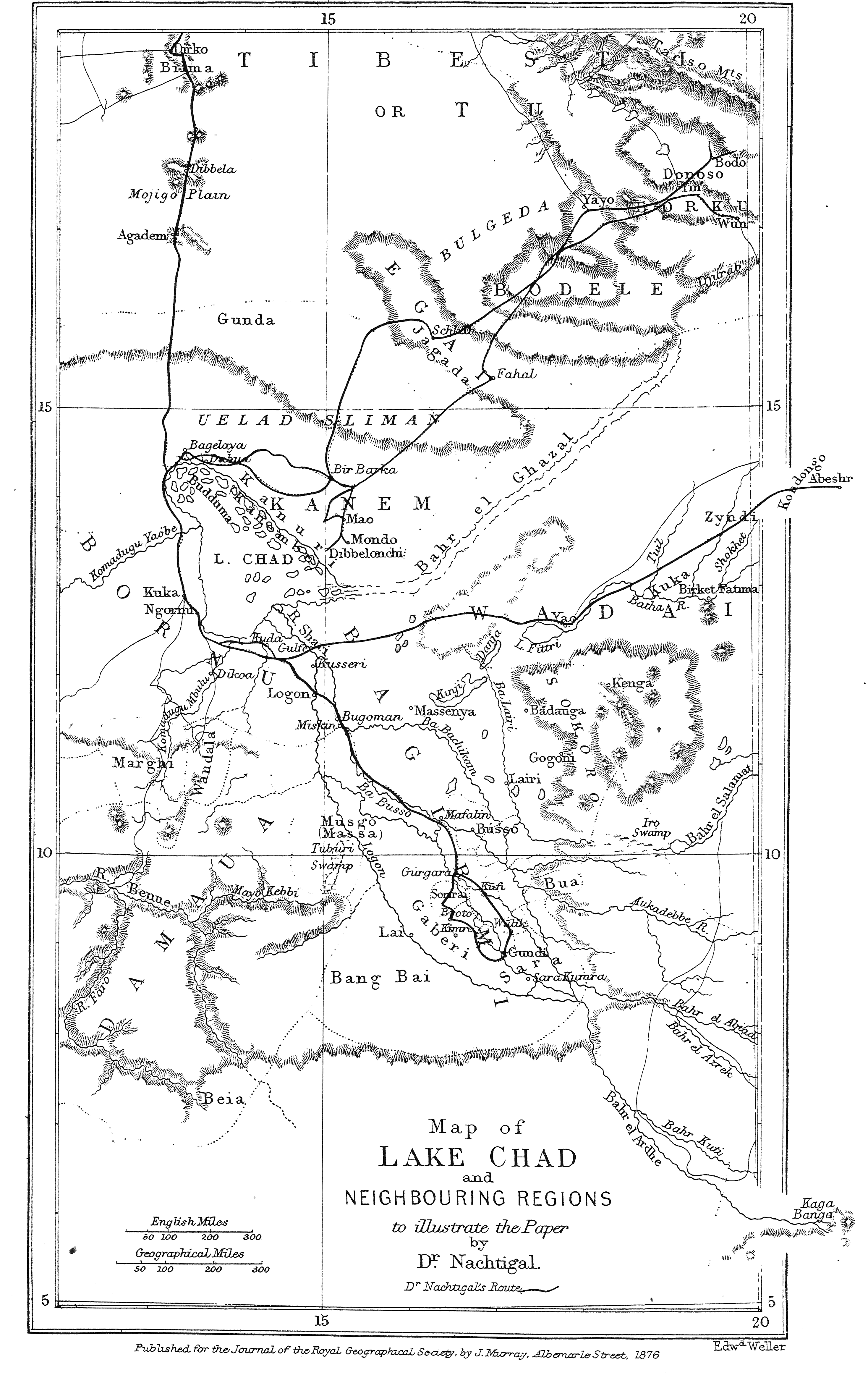
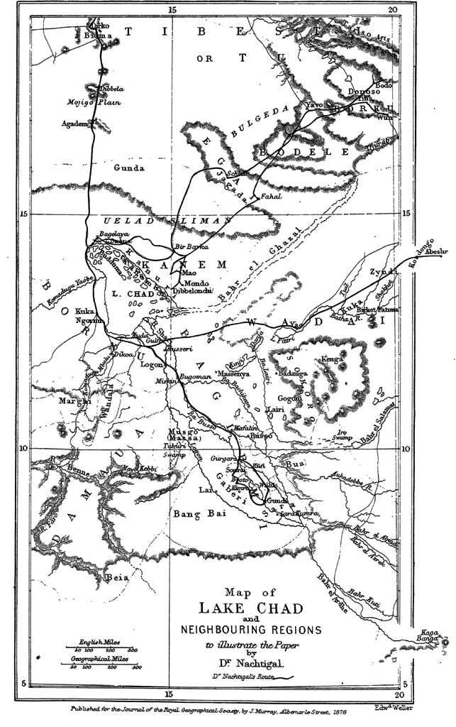
Original caption: " Map of Lake Chad and Neighbouring Regions " |
||||
| Date | before 1876 | ||||
| Source | Gustav Nachtigal, Journey to Lake Chad and Neighbouring Regions, In: The Journal of the Royal Geographical Society, vol. 46, 1876, p.396-411 | ||||
| Author |
Gustav Nachtigal, Edward Weller, |
||||
| Permission (Reusing this file) |
|
||||
File history
Click on a date/time to view the file as it appeared at that time.
| Date/Time | Thumbnail | Dimensions | User | Comment | |
|---|---|---|---|---|---|
| current | 11:46, 5 April 2016 | | 2,936 × 4,677 (3 MB) | Katharinaiv (talk | contribs) | {{Information |Description={{original caption|Map of Lake Chad an neighbouring regions}} |Source=Gustav Nachtigal, ''Journey to lake Chad an Neighbouring Regions", In: ''The Journal of the Royal Geographical Society'', vol. 46, 1876, 396-411 |Date={{ot... |
You cannot overwrite this file.
File usage on Commons
There are no pages that use this file.
File usage on other wikis
The following other wikis use this file:
- Usage on nl.wikipedia.org