File:Map MD Sidney1850 OldHarfordRd south LABELEDcrop.GIF

Size of this preview: 800 × 498 pixels. Other resolutions: 320 × 199 pixels | 640 × 398 pixels | 1,024 × 637 pixels | 1,352 × 841 pixels.
Original file (1,352 × 841 pixels, file size: 832 KB, MIME type: image/gif)
Captions
Captions
Add a one-line explanation of what this file represents
Summary edit
| Description |
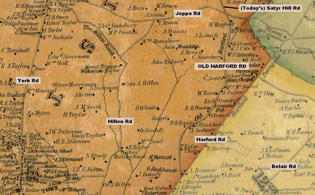
English: Part of 1850 Sidney map of Maryland, annotated to show Old Harford Rd in relation to other roads...south sector |
| Date | |
| Source | Own work |
| Author | Accas1; annotated by Stephen Corfidi |
Licensing edit
I, the copyright holder of this work, hereby publish it under the following license:
This file is licensed under the Creative Commons Attribution-Share Alike 3.0 Unported license.
- You are free:
- to share – to copy, distribute and transmit the work
- to remix – to adapt the work
- Under the following conditions:
- attribution – You must give appropriate credit, provide a link to the license, and indicate if changes were made. You may do so in any reasonable manner, but not in any way that suggests the licensor endorses you or your use.
- share alike – If you remix, transform, or build upon the material, you must distribute your contributions under the same or compatible license as the original.
File history
Click on a date/time to view the file as it appeared at that time.
| Date/Time | Thumbnail | Dimensions | User | Comment | |
|---|---|---|---|---|---|
| current | 13:17, 5 February 2012 | | 1,352 × 841 (832 KB) | Accas1 (talk | contribs) |
You cannot overwrite this file.
File usage on Commons
There are no pages that use this file.
File usage on other wikis
The following other wikis use this file:
- Usage on en.wikipedia.org