File:Map Saikai en.png

Size of this preview: 800 × 475 pixels. Other resolutions: 320 × 190 pixels | 640 × 380 pixels | 1,181 × 701 pixels.
Original file (1,181 × 701 pixels, file size: 37 KB, MIME type: image/png)
Captions
Captions
Add a one-line explanation of what this file represents
Summary
edit
| Description |
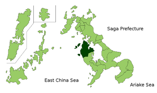
Map of Nagasaki Prefecture highlighting Saikai city. Borders of map as of July, 2006. (blank map used from [1]) See also Image:NagasakiMapCurrent.png. |
| Date | 29 July 2006 (original upload date) |
| Source | No machine-readable source provided. Own work assumed (based on copyright claims). |
| Author | No machine-readable author provided. Akanemoto~commonswiki assumed (based on copyright claims). |
Licensing
edit
| I, the copyright holder of this work, release this work into the public domain. This applies worldwide. In some countries this may not be legally possible; if so: I grant anyone the right to use this work for any purpose, without any conditions, unless such conditions are required by law. |
File history
Click on a date/time to view the file as it appeared at that time.
| Date/Time | Thumbnail | Dimensions | User | Comment | |
|---|---|---|---|---|---|
| current | 22:52, 29 July 2006 | | 1,181 × 701 (37 KB) | Akanemoto~commonswiki (talk | contribs) | Map of Nagasaki Prefecture highlighting Saikai city. Borders of map as of July, 2006. (blank map used from [http://aoki2.si.gunma-u.ac.jp/map/map.html]) See also Image:NagasakiMapCurrent.png. Category:Saikai, Nagasaki [[Category:Maps of Nagasak |
You cannot overwrite this file.
File usage on Commons
There are no pages that use this file.
File usage on other wikis
The following other wikis use this file:
- Usage on fa.wikipedia.org
- Usage on it.wikipedia.org
- Usage on tg.wikipedia.org
- Usage on vi.wikipedia.org