File:Map Slovakia districts 2004.png
Size of this preview: 800 × 393 pixels. Other resolutions: 320 × 157 pixels | 944 × 464 pixels.
Original file (944 × 464 pixels, file size: 54 KB, MIME type: image/png)
Captions
Captions
Add a one-line explanation of what this file represents
Summary edit
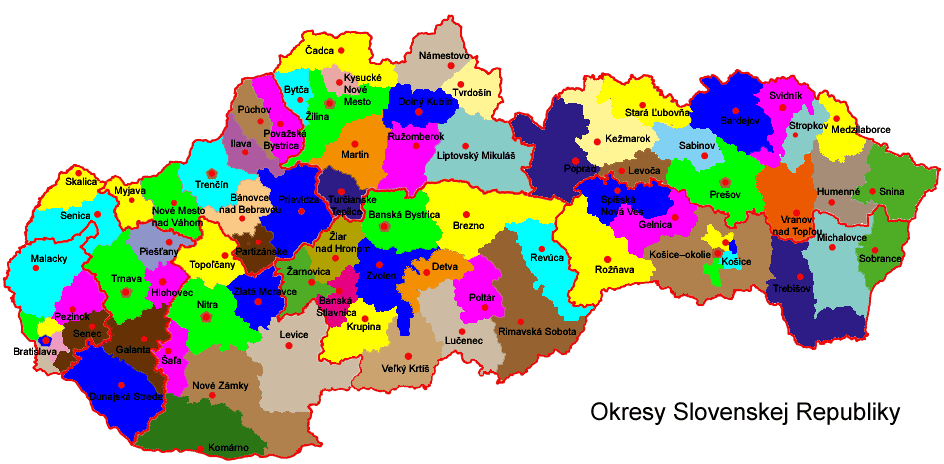
Slovakia divided into districts (as of 2004)
Licensing edit

|
Permission is granted to copy, distribute and/or modify this document under the terms of the GNU Free Documentation License, Version 1.2 or any later version published by the Free Software Foundation; with no Invariant Sections, no Front-Cover Texts, and no Back-Cover Texts. A copy of the license is included in the section entitled GNU Free Documentation License. |
| This file is licensed under the Creative Commons Attribution-Share Alike 3.0 Unported license. | ||
| ||
| This licensing tag was added to this file as part of the GFDL licensing update. |
File history
Click on a date/time to view the file as it appeared at that time.
| Date/Time | Thumbnail | Dimensions | User | Comment | |
|---|---|---|---|---|---|
| current | 15:29, 14 September 2005 | | 944 × 464 (54 KB) | PM (talk | contribs) | Slovakia divided into districts (as of 2004) From Obrázok:Slovensko okresy.png at sk:wiki. |
| 15:28, 14 September 2005 |  | 944 × 464 (54 KB) | PM (talk | contribs) | Slovakia divided into districts (as of 2004) |
You cannot overwrite this file.
File usage on Commons
There are no pages that use this file.
File usage on other wikis
The following other wikis use this file:
- Usage on be-tarask.wikipedia.org
- Usage on be.wikipedia.org
- Usage on ce.wikipedia.org
- Usage on en.wikipedia.org
- Usage on hu.wikipedia.org
- Usage on ka.wikipedia.org
- Usage on ru.wikipedia.org
- Usage on sk.wikipedia.org
- Usage on uk.wikipedia.org