File:Map Tours.jpg
Size of this preview: 394 × 599 pixels. Other resolutions: 158 × 240 pixels | 316 × 480 pixels | 505 × 768 pixels | 673 × 1,024 pixels | 1,620 × 2,463 pixels.
Original file (1,620 × 2,463 pixels, file size: 4.03 MB, MIME type: image/jpeg)
Captions
Captions
Add a one-line explanation of what this file represents
Summary edit
| Description |
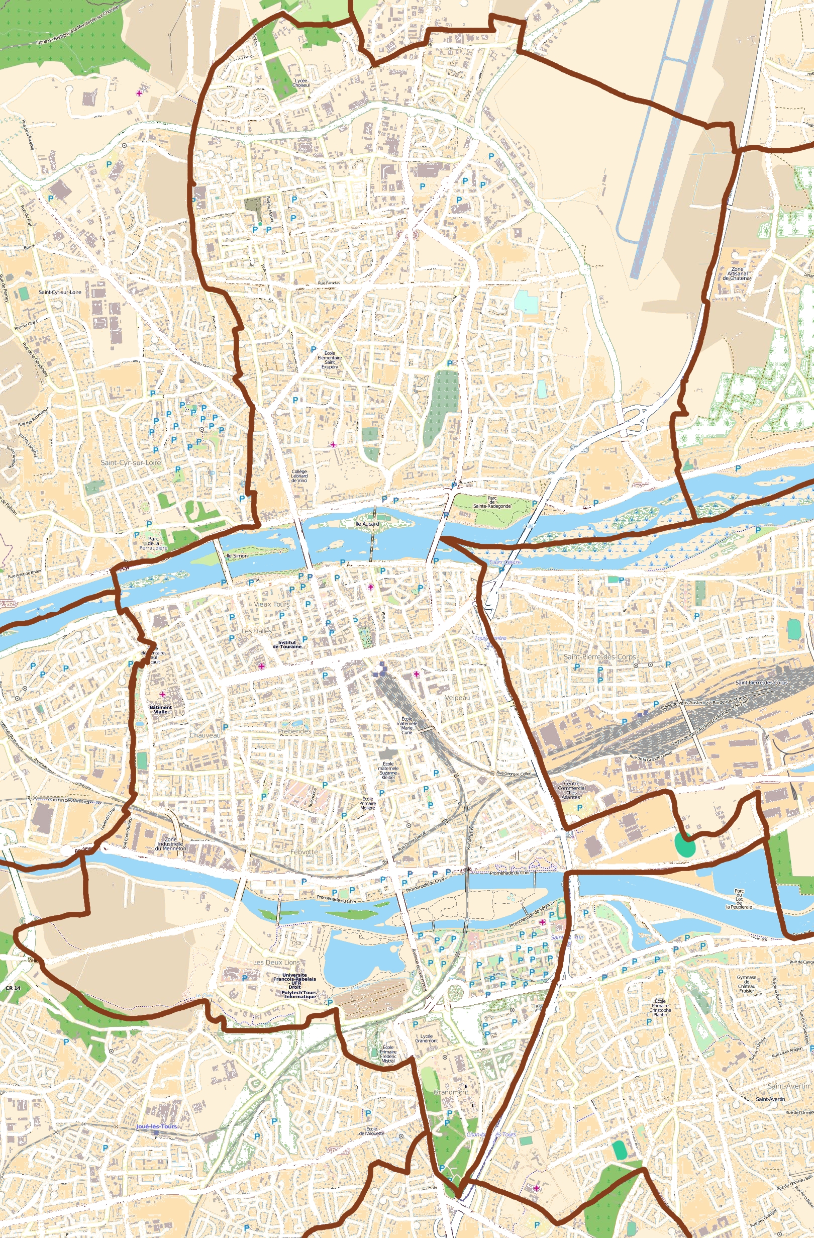
English: Map of Tours, France
Français : Carte de Tours, France |
||||||||||||
| Date | |||||||||||||
| Source |
|
||||||||||||
| Author | OpenStreetMap contributors |
Licensing edit
This file is licensed under the Creative Commons Attribution-Share Alike 3.0 Unported license.
- You are free:
- to share – to copy, distribute and transmit the work
- to remix – to adapt the work
- Under the following conditions:
- attribution – You must give appropriate credit, provide a link to the license, and indicate if changes were made. You may do so in any reasonable manner, but not in any way that suggests the licensor endorses you or your use.
- share alike – If you remix, transform, or build upon the material, you must distribute your contributions under the same or compatible license as the original.
File history
Click on a date/time to view the file as it appeared at that time.
| Date/Time | Thumbnail | Dimensions | User | Comment | |
|---|---|---|---|---|---|
| current | 15:36, 29 July 2011 | | 1,620 × 2,463 (4.03 MB) | XIIIfromTOKYO (talk | contribs) | {{Information |Description ={{en|1=Map of Tours, France}} {{fr|1=Carte de Tours, France}} |Source ={{openstreetmap}} |Author =OpenStreetMap contributors |Date =2011-07-28 |Permission = |other_versions = }} [[Category:Tour |
You cannot overwrite this file.
File usage on Commons
There are no pages that use this file.
File usage on other wikis
The following other wikis use this file:
- Usage on ar.wikipedia.org
- Usage on ceb.wikipedia.org
- Usage on da.wikipedia.org
- Usage on eo.wikipedia.org
- Usage on es.wikipedia.org
- Usage on fa.wikipedia.org
- Usage on fr.wikipedia.org
- Sainte-Radegonde-en-Touraine
- Stade de la Vallée du Cher
- École polytechnique de l'université de Tours
- Patinoire de Tours
- Art à Tours
- Quartier Saint-Symphorien de Tours
- Musée des Beaux-Arts de Tours
- Hôtel de ville de Tours
- Palais de justice de Tours
- École supérieure des beaux-arts de Tours
- Amphithéâtre de Tours
- Abbaye de Marmoutier de Tours
- Centre international de congrès de Tours
- Centre municipal des sports
- Quartiers du Vieux-Tours
- Tour Charlemagne
- École Brassart
- Les Années Joué
- École publique de journalisme de Tours
- Deux-Lions
- Hôtel Goüin
- Lycée Descartes (Tours)
- Synagogue de Tours
- Quartier des Fontaines de Tours
- Centre hospitalier régional universitaire de Tours
- Château de Tours
- Campus de Grandmont
- Pont d'Eudes
- Quartier Giraudeau
- La Rabaterie
- Bibliothèque municipale de Tours
- Stade Tonnellé
- Archives départementales d'Indre-et-Loire
- Église Saint-Grégoire des Minimes
- Hôtel de préfecture d'Indre-et-Loire
- Avenue de Grammont
- Rue Nationale (Tours)
View more global usage of this file.