File:Map europe NORD.LINK NorGer NorNedr cable.svg

Size of this PNG preview of this SVG file: 100 × 120 pixels. Other resolutions: 200 × 240 pixels | 400 × 480 pixels | 640 × 768 pixels | 853 × 1,024 pixels | 1,707 × 2,048 pixels.
Original file (SVG file, nominally 100 × 120 pixels, file size: 101 KB)
Captions
Captions
Add a one-line explanation of what this file represents
Summary edit
| Description |
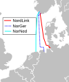
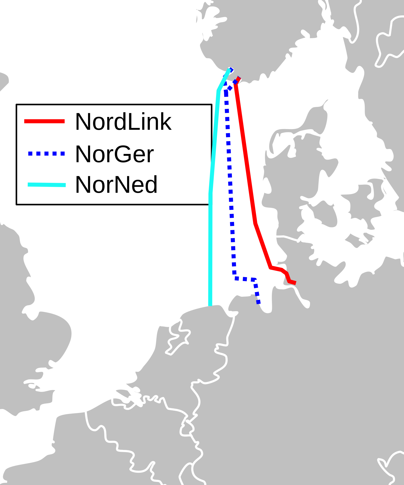
Deutsch: Leitungsverlauf der NORD.LINK (rot), NorNed (türkis) und der geplante Leitungsverlauf (mehrere Varianten) der NorGer (blau punktiert) |
| Date | |
| Source |
File:Map_europe_NORD.LINK_and_NorGer_cable.svg https://de.wikipedia.org/wiki/Datei:Blank_map_europe_Nordned_cable.svg |
| Author | Wdwd; for map see File:Blank_map_europe.svg |
Licensing edit
| This file is made available under the Creative Commons CC0 1.0 Universal Public Domain Dedication. | |
| The person who associated a work with this deed has dedicated the work to the public domain by waiving all of their rights to the work worldwide under copyright law, including all related and neighboring rights, to the extent allowed by law. You can copy, modify, distribute and perform the work, even for commercial purposes, all without asking permission.
|
File history
Click on a date/time to view the file as it appeared at that time.
| Date/Time | Thumbnail | Dimensions | User | Comment | |
|---|---|---|---|---|---|
| current | 17:52, 8 December 2020 | | 100 × 120 (101 KB) | Sally Bach (talk | contribs) | Beschriftung |
| 17:45, 8 December 2020 |  | 100 × 120 (101 KB) | Sally Bach (talk | contribs) | Uploaded a work by Wdwd; for map see File:Blank_map_europe.svg from https://commons.wikimedia.org/wiki/File:Map_europe_NORD.LINK_and_NorGer_cable.svg https://de.wikipedia.org/wiki/Datei:Blank_map_europe_Nordned_cable.svg with UploadWizard |
You cannot overwrite this file.
File usage on Commons
There are no pages that use this file.
File usage on other wikis
The following other wikis use this file:
- Usage on de.wikipedia.org
- Usage on lv.wikipedia.org
- Usage on nl.wikipedia.org