File:Map of Adforton from the 20th Century..PNG
No higher resolution available.
Map_of_Adforton_from_the_20th_Century..PNG (719 × 477 pixels, file size: 892 KB, MIME type: image/png)
Captions
Captions
Add a one-line explanation of what this file represents
Summary edit
| Description |
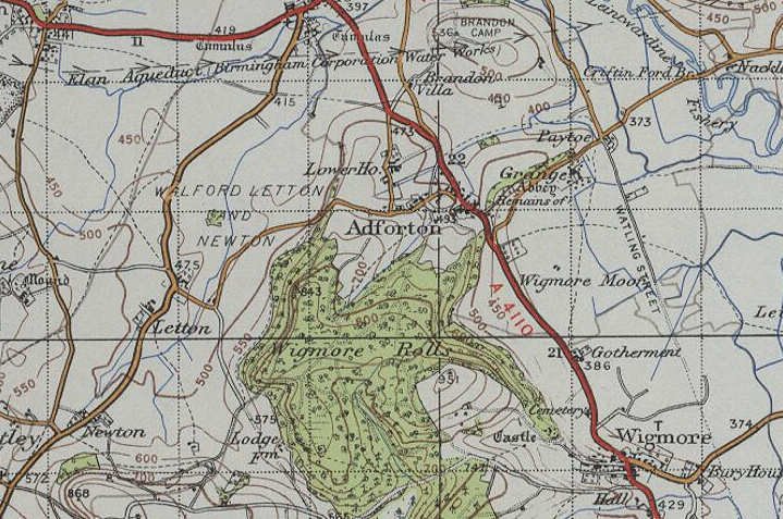
English: A map Designed in the 20th century by the Ordnance Survey, which shows the location of Adforton and its surroundings. |
| Date | |
| Source | http://www.visionofbritain.org.uk/maps/sheet/new_pop/264_129 |
| Author | Ordnance survey |
Licensing edit
This file is licensed under the Creative Commons Attribution-Share Alike 4.0 International license.
- You are free:
- to share – to copy, distribute and transmit the work
- to remix – to adapt the work
- Under the following conditions:
- attribution – You must give appropriate credit, provide a link to the license, and indicate if changes were made. You may do so in any reasonable manner, but not in any way that suggests the licensor endorses you or your use.
- share alike – If you remix, transform, or build upon the material, you must distribute your contributions under the same or compatible license as the original.
File history
Click on a date/time to view the file as it appeared at that time.
| Date/Time | Thumbnail | Dimensions | User | Comment | |
|---|---|---|---|---|---|
| current | 18:55, 23 April 2015 | | 719 × 477 (892 KB) | Mattallen8 (talk | contribs) | User created page with UploadWizard |
You cannot overwrite this file.
File usage on Commons
There are no pages that use this file.
File usage on other wikis
The following other wikis use this file: