File:Map of Alaska highlighting Kodiak Island Borough.svg

Size of this PNG preview of this SVG file: 800 × 423 pixels. Other resolutions: 320 × 169 pixels | 640 × 338 pixels | 1,024 × 541 pixels | 1,280 × 677 pixels | 2,560 × 1,353 pixels | 1,470 × 777 pixels.
Original file (SVG file, nominally 1,470 × 777 pixels, file size: 338 KB)
Captions
Captions
Add a one-line explanation of what this file represents
Summary edit
| Description |
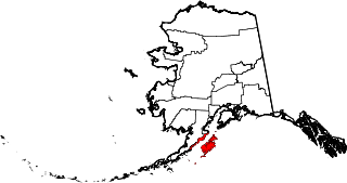
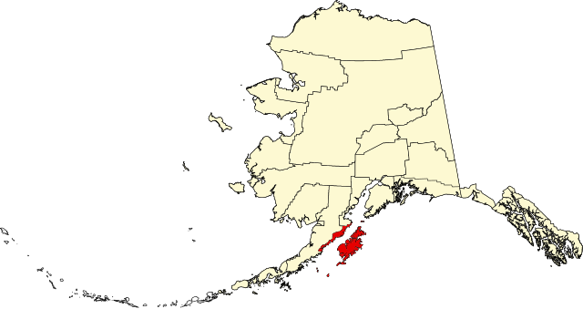
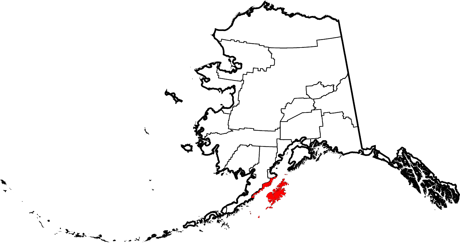
English: This is a locator map showing Kodiak Island Borough in Alaska |
| Date | |
| Source |
Own work: English: The maps use data from nationalatlas.gov, specifically countyp020.tar.gz on the Raw Data Download page. The maps also use state outline data from statesp020.tar.gz. The Florida maps use hydrogm020.tar.gz to display Lake Okeechobee. |
| Author | David Benbennick |
Licensing edit
| I, the copyright holder of this work, release this work into the public domain. This applies worldwide. In some countries this may not be legally possible; if so: I grant anyone the right to use this work for any purpose, without any conditions, unless such conditions are required by law. |
File history
Click on a date/time to view the file as it appeared at that time.
| Date/Time | Thumbnail | Dimensions | User | Comment | |
|---|---|---|---|---|---|
| current | 19:27, 5 March 2006 | | 1,470 × 777 (338 KB) | David Benbennick (talk | contribs) | {{subst:User:Dbenbenn/clm|county=Kodiak Island Borough|state=Alaska|type=borough and census area}} |
You cannot overwrite this file.
File usage on Commons
The following 2 pages use this file:
File usage on other wikis
The following other wikis use this file:
- Usage on bpy.wikipedia.org
- Usage on ca.wikipedia.org
- Usage on ceb.wikipedia.org
- Usage on ce.wikipedia.org
- Usage on cy.wikipedia.org
- Usage on de.wikipedia.org
- Usage on en.wikipedia.org
- List of boroughs and census areas in Alaska
- Kodiak Island Borough, Alaska
- Akhiok, Alaska
- Aleneva, Alaska
- Chiniak, Alaska
- Karluk, Alaska
- Kodiak, Alaska
- Kodiak Station, Alaska
- Larsen Bay, Alaska
- Old Harbor, Alaska
- Ouzinkie, Alaska
- Port Lions, Alaska
- Womens Bay, Alaska
- Kodiak Island
- Afognak
- Shelikof Strait
- Three Saints Bay, Alaska
- Karluk River
- Afognak, Alaska
- Mount Kaguyak
- Mount Mageik
- User:Jnestorius/Regions with significant island landmass
- Chirikof Island
View more global usage of this file.