File:Map of Fourth Creek Congregation.jpg
Size of this preview: 484 × 599 pixels. Other resolutions: 194 × 240 pixels | 388 × 480 pixels | 620 × 768 pixels | 827 × 1,024 pixels | 1,597 × 1,977 pixels.
Original file (1,597 × 1,977 pixels, file size: 455 KB, MIME type: image/jpeg)
Captions
Captions
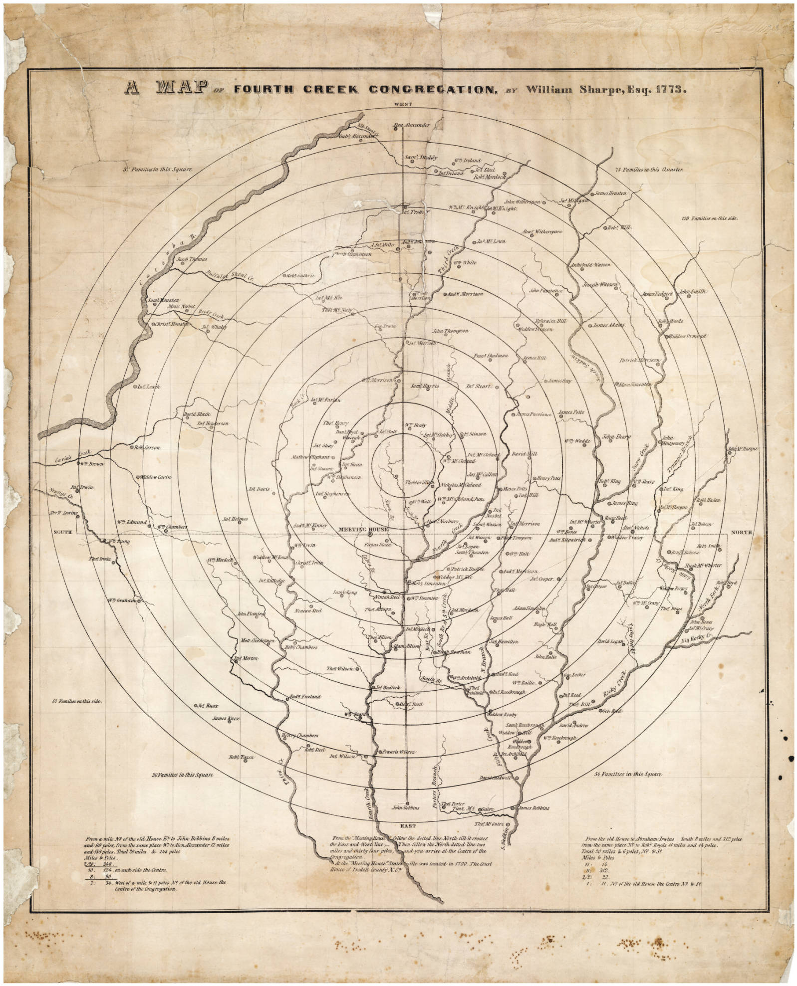
Map of the Fourth Creek Congregation created by WIlliam Sharpe in 1773
Summary edit
| Description |
English: This map shows the location of members of the Fourth Creek Congregation that was located in Rowan County, Province of North Carolina. It was created by a member of the Fourth Creek Congregation, William Sharpe, in 1773 and was published in 1847. The map depicts creeks, streams, landowners, and churches in this area of Rowan County, near the present day town of Statesville, Iredell County, North Carolina |
| Date | |
| Source | https://dc.lib.unc.edu/cdm/ref/collection/ncmaps/id/118 |
| Author | William Sharpe created this map in 1773, it was published in 1847 |
| Camera location | | View this and other nearby images on: OpenStreetMap |
|---|
Licensing edit
|
This work is in the public domain in its country of origin and other countries and areas where the copyright term is the author's life plus 70 years or fewer. This work is in the public domain in the United States because it was published (or registered with the U.S. Copyright Office) before January 1, 1929. | |
| This file has been identified as being free of known restrictions under copyright law, including all related and neighboring rights. | |
File history
Click on a date/time to view the file as it appeared at that time.
| Date/Time | Thumbnail | Dimensions | User | Comment | |
|---|---|---|---|---|---|
| current | 04:20, 5 February 2019 | | 1,597 × 1,977 (455 KB) | G. Moore (talk | contribs) | User created page with UploadWizard |
You cannot overwrite this file.
File usage on Commons
There are no pages that use this file.
File usage on other wikis
The following other wikis use this file:
- Usage on en.wikipedia.org