File:Map of Iraq, 1976.jpg

Size of this preview: 621 × 599 pixels. Other resolutions: 249 × 240 pixels | 497 × 480 pixels | 796 × 768 pixels | 1,064 × 1,027 pixels.
Original file (1,064 × 1,027 pixels, file size: 395 KB, MIME type: image/jpeg)
Captions
Captions
Add a one-line explanation of what this file represents
| Description |
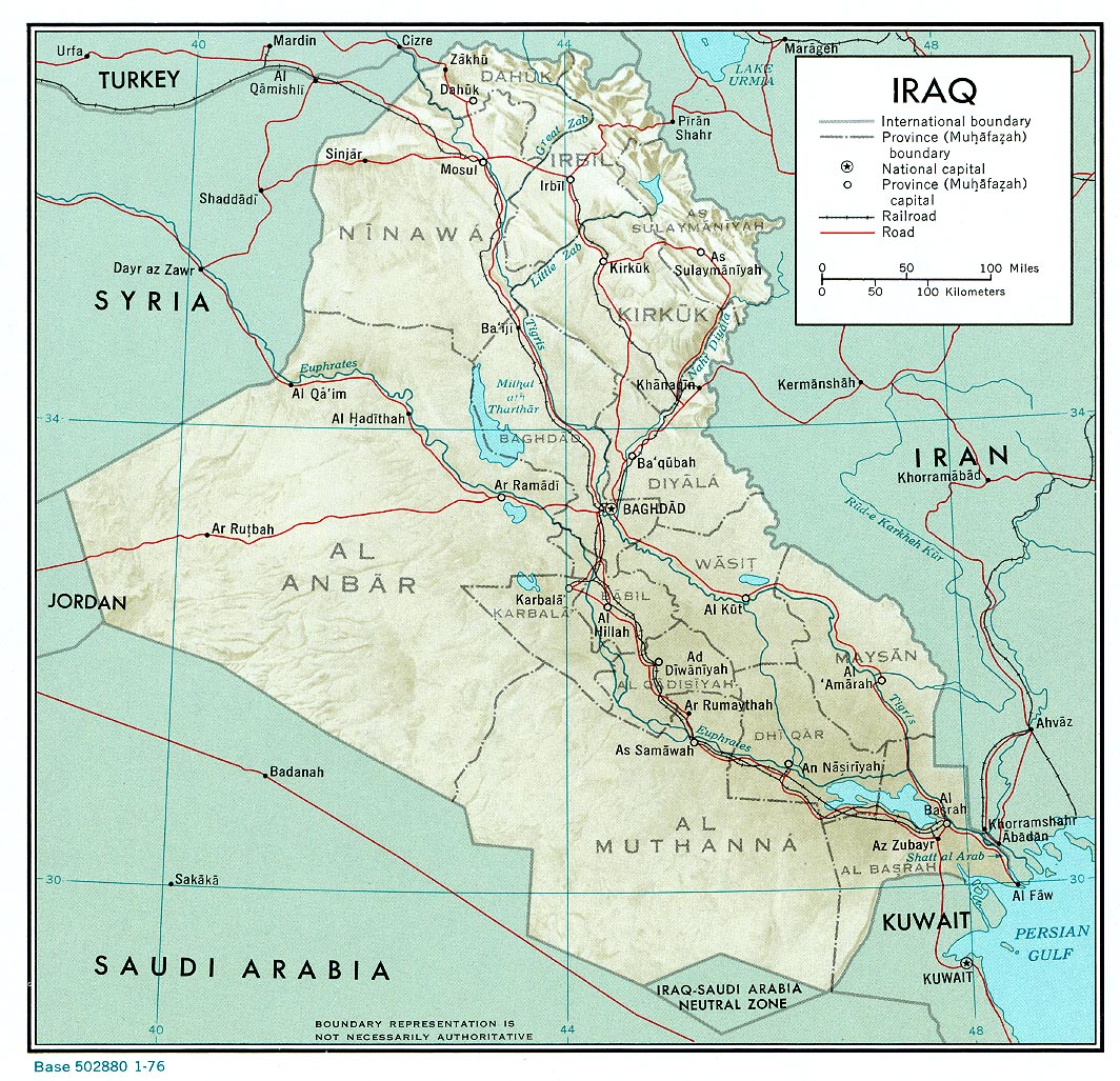
English: A map of Iraq, drawn in 1976. It shows the old province boundaries and other topographical detail. It is referred to here as a work of the CIA. |
|||
| Date | ||||
| Source | http://www.lib.utexas.edu/maps/middle_east_and_asia/iraq_rel_1976.jpg | |||
| Author | Employee(s) of the Central Intelligence Agency | |||
| Permission (Reusing this file) |
|
|||
| Other versions |
File:Neutralzone.jpg, cropped section of Neutral Zone. File:Map of Iraq, 1976-ar.jpg, in Arabic |

File history
Click on a date/time to view the file as it appeared at that time.
| Date/Time | Thumbnail | Dimensions | User | Comment | |
|---|---|---|---|---|---|
| current | 13:03, 11 June 2010 | | 1,064 × 1,027 (395 KB) | Jarry1250 (talk | contribs) | {{Information |Description={{en|1=A map of Iraq, drawn in 1976. It shows the old province boundaries and other topographical detail. It is referred to [http://www.lib.utexas.edu/maps/iraq.html here] as a work of the CIA.}} |Source=http://www.lib.utexas. |
You cannot overwrite this file.
File usage on Commons
The following page uses this file:
File usage on other wikis
The following other wikis use this file:
- Usage on ar.wikipedia.org
- Usage on en.wikipedia.org
- Usage on es.wikipedia.org
- Usage on fa.wikipedia.org
- Usage on zh.wikipedia.org