File:Map of Jefferson County, Kentucky - showing the names of property holders, division lines of farms, position of houses, churches, school-houses, roads, water-courses, distances, and the topographical LOC 78694303.tif

Size of this JPG preview of this TIF file: 665 × 600 pixels. Other resolutions: 266 × 240 pixels | 532 × 480 pixels | 851 × 768 pixels | 1,135 × 1,024 pixels | 2,270 × 2,048 pixels | 15,436 × 13,924 pixels.
Original file (15,436 × 13,924 pixels, file size: 614.92 MB, MIME type: image/tiff)
Captions
Captions
Add a one-line explanation of what this file represents
Summary edit
| Warning | The original file is very high-resolution. It might not load properly or could cause your browser to freeze when opened at full size. |
|---|
| Description |
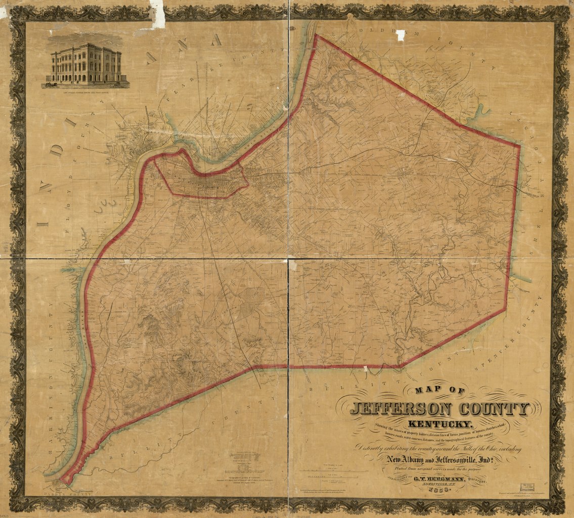
English: Scale 1:42,240; 1 1/2 in. to a mile. Hand colored. Relief shown by hachures. Cadastral map. Includes statistical data and ill. LC Land ownership maps, 234 Available also through the Library of Congress Web site as a raster image. AACR2: 651/1; 650/2 |
||
| Title | Map of Jefferson County, Kentucky : showing the names of property holders, division lines of farms, position of houses, churches, school-houses, roads, water-courses, distances, and the topographical features of the county : distinctly exhibiting the country around the falls of the Ohio, including New Albany and Jeffersonville, Inda. | ||
| Shelf ID | G3953.J4 1858 .B4 | ||
| Date | |||
| Source | https://www.loc.gov/item/78694303/ | ||
| Author | Bergmann, G. T.; Korff Brothers | ||
| Permission (Reusing this file) |
|
||
| Other versions |
|
||
| Location | Jefferson County · United States · Kentucky | ||
| Part of | American Memory · Catalog · County Landownership Maps · Geography And Map Division · Cultural Landscapes | ||
| Subject | Jefferson County · Kentucky · United States · Maps · Real Property · Jefferson County (Ky.) |


Licensing edit
|
This is a faithful photographic reproduction of a two-dimensional, public domain work of art. The work of art itself is in the public domain for the following reason:
The official position taken by the Wikimedia Foundation is that "faithful reproductions of two-dimensional public domain works of art are public domain".
This photographic reproduction is therefore also considered to be in the public domain in the United States. In other jurisdictions, re-use of this content may be restricted; see Reuse of PD-Art photographs for details. | ||||
File history
Click on a date/time to view the file as it appeared at that time.
| Date/Time | Thumbnail | Dimensions | User | Comment | |
|---|---|---|---|---|---|
| current | 07:03, 26 June 2018 |  | 15,436 × 13,924 (614.92 MB) | Fæ (talk | contribs) | LOC Maps https://www.loc.gov/item/78694303/ #29026 |
You cannot overwrite this file.
File usage on Commons
The following page uses this file: