File:Map of Kurashiki Tivoli Park.jpg
Size of this preview: 800 × 540 pixels. Other resolutions: 320 × 216 pixels | 640 × 432 pixels | 1,126 × 760 pixels.
Original file (1,126 × 760 pixels, file size: 698 KB, MIME type: image/jpeg)
Captions
Captions
Add a one-line explanation of what this file represents
Summary
edit
| Description |
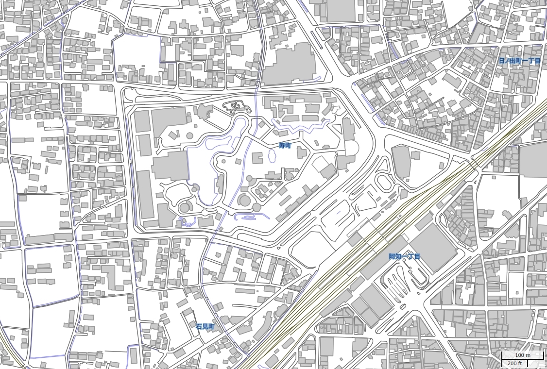
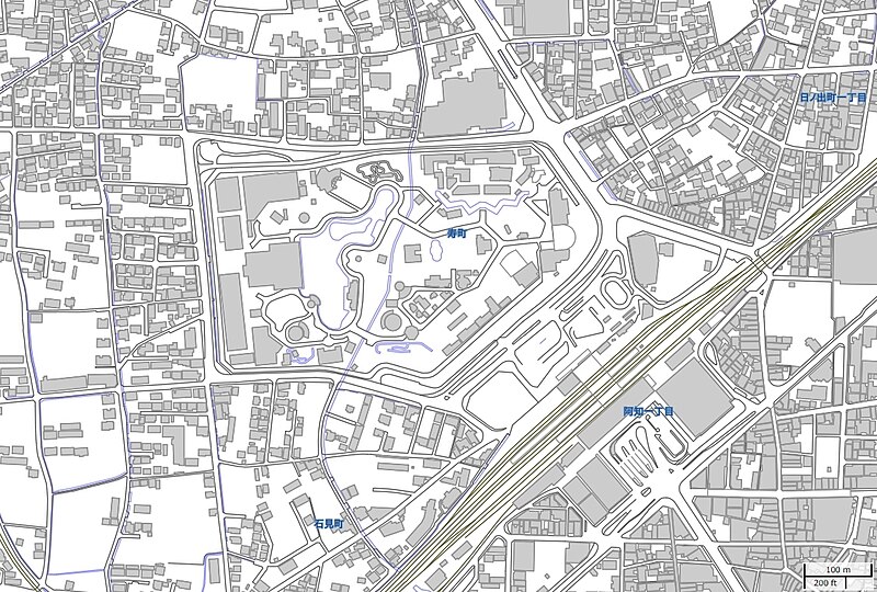
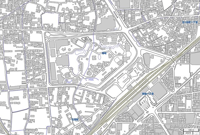
日本語: 岡山県倉敷市にあった倉敷チボリ公園の地図。
English: Map of Kurashiki Tivoli Park, Kurashiki, Okayama pref Japan. |
| Date | |
| Source | https://aginfo.cgk.affrc.go.jp/mapprv/mapext.html.ja 農研機構 |
| Author | Edits: Krorokeroro (talk · contribs) が農研機構を加工して作成 |
Licensing
edit
This file is licensed under the Creative Commons Attribution 4.0 International license.
- You are free:
- to share – to copy, distribute and transmit the work
- to remix – to adapt the work
- Under the following conditions:
- attribution – You must give appropriate credit, provide a link to the license, and indicate if changes were made. You may do so in any reasonable manner, but not in any way that suggests the licensor endorses you or your use.
File history
Click on a date/time to view the file as it appeared at that time.
| Date/Time | Thumbnail | Dimensions | User | Comment | |
|---|---|---|---|---|---|
| current | 14:58, 18 March 2023 | | 1,126 × 760 (698 KB) | Krorokeroro (talk | contribs) | Uploaded a work by Edits: {{user|Krorokeroro}} が[https://aginfo.cgk.affrc.go.jp/mapprv/mapext.html.ja 農研機構]を加工して作成 from https://aginfo.cgk.affrc.go.jp/mapprv/mapext.html.ja 農研機構 with UploadWizard |
You cannot overwrite this file.
File usage on Commons
There are no pages that use this file.
File usage on other wikis
The following other wikis use this file:
- Usage on ja.wikipedia.org