File:Map of Medina Township, Warren County, Indiana.svg

Size of this PNG preview of this SVG file: 600 × 600 pixels. Other resolutions: 240 × 240 pixels | 480 × 480 pixels | 768 × 768 pixels | 1,024 × 1,024 pixels | 2,048 × 2,048 pixels.
Original file (SVG file, nominally 768 × 768 pixels, file size: 195 KB)
Captions
Captions
Add a one-line explanation of what this file represents
Summary
edit
| Description |
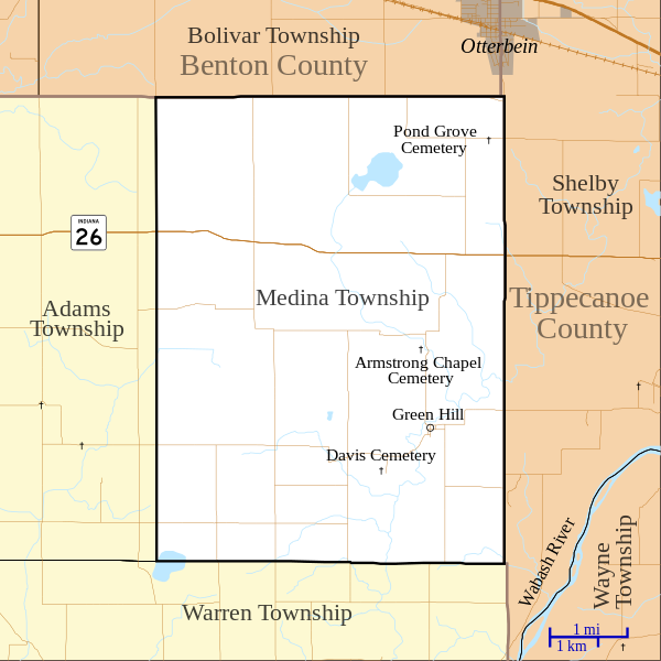
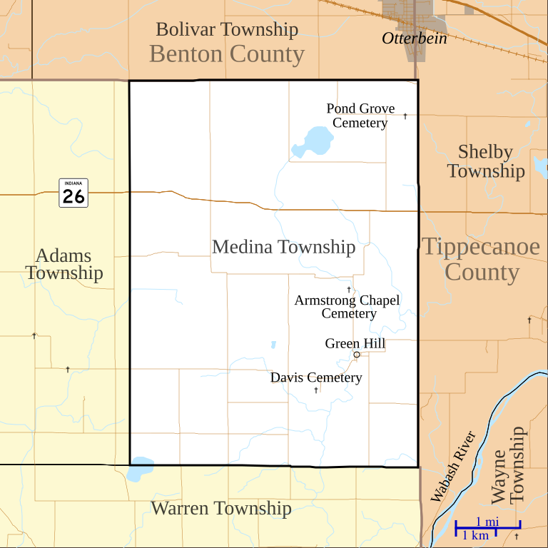
English: This is a map of Medina Township, Warren County, Indiana, USA. |
| Date | |
| Source | My own work, using custom-written MapScript applications with United States Census Bureau TIGER 2010 data |
| Author | Omnedon |
Licensing
edit
| I, the copyright holder of this work, release this work into the public domain. This applies worldwide. In some countries this may not be legally possible; if so: I grant anyone the right to use this work for any purpose, without any conditions, unless such conditions are required by law. |
File history
Click on a date/time to view the file as it appeared at that time.
| Date/Time | Thumbnail | Dimensions | User | Comment | |
|---|---|---|---|---|---|
| current | 03:38, 27 January 2011 | | 768 × 768 (195 KB) | Omnedon (talk | contribs) | == {{int:filedesc}} == {{Information |Description={{en|This is a map of Medina Township, Warren County, Indiana, USA.}} |Source=My own work, using custom-written MapScript applications with [http://www.census |
You cannot overwrite this file.
File usage on Commons
There are no pages that use this file.
File usage on other wikis
The following other wikis use this file:
- Usage on en.wikipedia.org
- Usage on es.wikipedia.org