File:Map of Númenor.png

Size of this preview: 724 × 600 pixels. Other resolutions: 290 × 240 pixels | 579 × 480 pixels | 927 × 768 pixels | 1,184 × 981 pixels.
Original file (1,184 × 981 pixels, file size: 990 KB, MIME type: image/png)
Captions
Captions
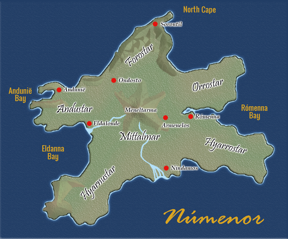
Map of Númenor
Summary edit
| Description |
English: Map of Númenor, the island of Westernesse in the Second Age of Tolkien's Middle-earth |
| Date | |
| Source | File:Mapa de Númenor.png |
| Author |
User:Severuksen (map) User:Chiswick Chap (translated labels) |
Licensing edit
This file is licensed under the Creative Commons Attribution 3.0 Unported license.
- You are free:
- to share – to copy, distribute and transmit the work
- to remix – to adapt the work
- Under the following conditions:
- attribution – You must give appropriate credit, provide a link to the license, and indicate if changes were made. You may do so in any reasonable manner, but not in any way that suggests the licensor endorses you or your use.
File history
Click on a date/time to view the file as it appeared at that time.
| Date/Time | Thumbnail | Dimensions | User | Comment | |
|---|---|---|---|---|---|
| current | 10:03, 24 April 2020 | | 1,184 × 981 (990 KB) | Chiswick Chap (talk | contribs) | rm stray diacritic |
| 08:48, 14 April 2020 |  | 1,184 × 981 (989 KB) | Chiswick Chap (talk | contribs) | Uploaded a work by User:Severuksen (map) User:Chiswick Chap (translated labels) from File:Mapa de Númenor.png with UploadWizard |
You cannot overwrite this file.
File usage on Commons
The following page uses this file:
File usage on other wikis
The following other wikis use this file:
- Usage on ca.wikipedia.org
- Usage on he.wikipedia.org
- Usage on pl.wikipedia.org
- Usage on uk.wikipedia.org
- Usage on www.wikidata.org