File:Map of Nagano Prefecture Ja.svg

Original file (SVG file, nominally 393 × 608 pixels, file size: 16 KB)
Captions
Captions
Summary edit
| Description |
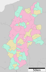
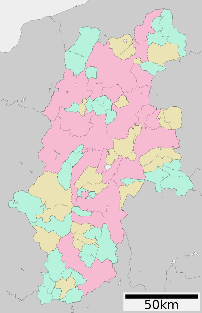
English: Map of Nagano Prefecture
日本語: ja:長野県区画図 |
||
| Date | 更新:2010年3月31日 | ||
| Source |
|
||
| Author | Lincun | ||
| Permission (Reusing this file) |
|
Licensing edit

|
Permission is granted to copy, distribute and/or modify this document under the terms of the GNU Free Documentation License, Version 1.2 or any later version published by the Free Software Foundation; with no Invariant Sections, no Front-Cover Texts, and no Back-Cover Texts. A copy of the license is included in the section entitled GNU Free Documentation License. |
- You are free:
- to share – to copy, distribute and transmit the work
- to remix – to adapt the work
- Under the following conditions:
- attribution – You must give appropriate credit, provide a link to the license, and indicate if changes were made. You may do so in any reasonable manner, but not in any way that suggests the licensor endorses you or your use.
- share alike – If you remix, transform, or build upon the material, you must distribute your contributions under the same or compatible license as the original.
File history
Click on a date/time to view the file as it appeared at that time.
| Date/Time | Thumbnail | Dimensions | User | Comment | |
|---|---|---|---|---|---|
| current | 11:22, 6 July 2013 | | 393 × 608 (16 KB) | ニンジンシチュー (talk | contribs) | Copied from ja:ファイル:包括自治体区画図 20000.svg |
| 15:58, 10 April 2010 |  | 393 × 608 (16 KB) | Lincun (talk | contribs) | {{基礎自治体位置図画像情報|長野県||20100331}} | |
| 06:58, 10 January 2010 |  | 393 × 608 (15 KB) | Lincun (talk | contribs) | {{基礎自治体位置図画像情報|長野県||20100101}} | |
| 20:04, 25 June 2009 |  | 464 × 760 (23 KB) | Krisgrotius (talk | contribs) | {{Information| |Description= Map of Nagano Prefecture |Source= Japanese wiki [http://ja.wikipedia.org/wiki/ファイル:包括自治体区画図_20000.svg http://ja.wikipedia.org/wiki/ファイル:包括自治体区画図_20000.svg] |Date=~~~~~ |Autho | |
| 13:25, 31 March 2009 |  | 464 × 760 (23 KB) | Lincun (talk | contribs) | {{基礎自治体位置図画像情報|長野県||20090331}} | |
| 21:57, 29 April 2008 |  | 580 × 972 (29 KB) | Krisgrotius (talk | contribs) | {{Information| |Description= Map of Nagano Prefecture, Japan. |Source= Japanese wiki [http://ja.wikipedia.org/wiki/%E7%94%BB%E5%83%8F:%E5%8C%85%E6%8B%AC%E8%87%AA%E6%B2%BB%E4%BD%93%E5%8C%BA%E7%94%BB%E5%9B%B3_20000.svg] |Date=~~~~~ |Author=[[:ja: 利用 | |
| 13:24, 3 October 2007 |  | 580 × 972 (29 KB) | Lincun (talk | contribs) | {{基礎自治体位置図画像情報|長野県|}} |
You cannot overwrite this file.
File usage on Commons
The following 3 pages use this file:
- Maps of Nagano prefecture
- Nagano prefecture
- File:包括自治体区画図 20000.svg (file redirect)
File usage on other wikis
The following other wikis use this file:
- Usage on de.wikipedia.org
- Usage on en.wikipedia.org
- Usage on gl.wikipedia.org
- Usage on id.wikipedia.org
- Usage on ja.wikipedia.org
- 長野県
- 三遠南信自動車道
- 松本城
- 長野県伊那弥生ヶ丘高等学校
- 長野県高遠高等学校
- 長野県赤穂高等学校
- 伊那西高等学校
- 長野県飯田高等学校
- 元善光寺
- 小諸城
- 龍岡城
- 高遠城
- 浅間温泉
- 長野県松本深志高等学校
- 長野県西部地震
- 長野県松本平広域公園総合球技場
- 松本空港
- 高島城
- 若槻
- 長野県諏訪清陵高等学校・附属中学校
- 長野県長野高等学校
- 長野県屋代高等学校・附属中学校
- 長野県須坂高等学校
- 長野県諏訪二葉高等学校
- 長野県須坂東高等学校
- 長野県松本蟻ヶ崎高等学校
- 長野県上田染谷丘高等学校
- 長野県篠ノ井高等学校
- 長野県阿南高等学校
- 長野県阿智高等学校
- 長野県岡谷東高等学校
- 長野県岡谷工業高等学校
- 長野県長野西高等学校中条校
- 長野県坂城高等学校
- 長野県諏訪実業高等学校
- 長野県富士見高等学校
- 長野県駒ヶ根工業高等学校
- 長野県下高井農林高等学校
- 長野県中野西高等学校
- 長野県下伊那農業高等学校
- 長野県長野工業高等学校
- 長野県蘇南高等学校
- 長野県梓川高等学校
- 長野県長野南高等学校
- 長野県丸子修学館高等学校
- 長野県望月高等学校
View more global usage of this file.