File:Map of Nansemond River, Virginia - DPLA - a58a5fa8d361016aac4578bac76b40a1.jpg
Size of this preview: 436 × 599 pixels. Other resolutions: 174 × 240 pixels | 349 × 480 pixels | 558 × 768 pixels | 745 × 1,024 pixels | 1,489 × 2,048 pixels | 5,499 × 7,561 pixels.
Original file (5,499 × 7,561 pixels, file size: 7.89 MB, MIME type: image/jpeg)
Captions
Captions
Add a one-line explanation of what this file represents
Summary
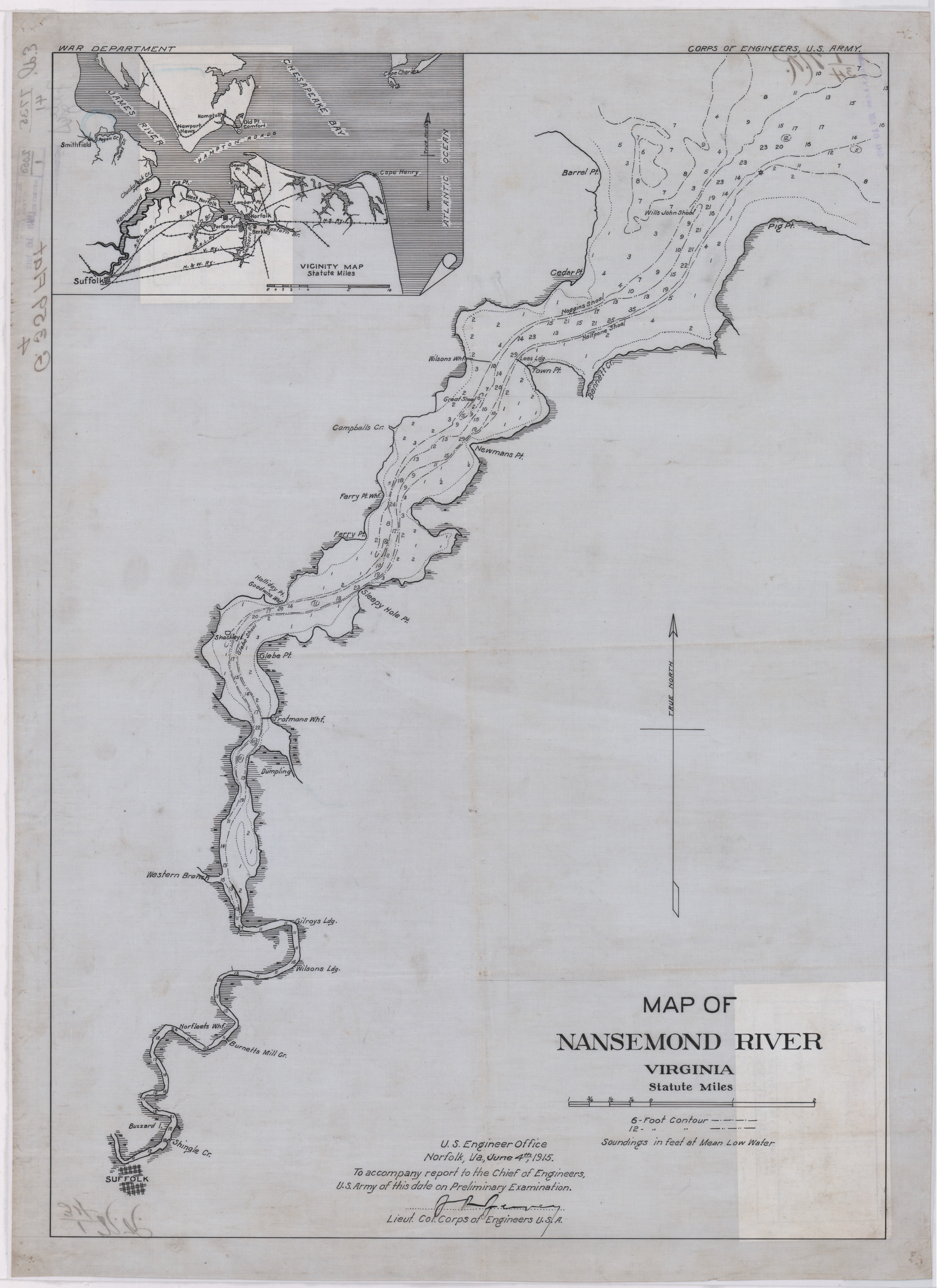
edit| Map of Nansemond River, Virginia
( |
||||||||||||||
|---|---|---|---|---|---|---|---|---|---|---|---|---|---|---|
| Creator | War Department. Office of the Chief of Engineers. 1818-9/18/1947 | |||||||||||||
| Title |
Map of Nansemond River, Virginia |
|||||||||||||
| Date | 1915 | |||||||||||||
| Collection |
|
|||||||||||||
| Source/Photographer |
|
|||||||||||||
| Permission (Reusing this file) |
|
|||||||||||||
| Standardized rights statement |
|
|||||||||||||


File history
Click on a date/time to view the file as it appeared at that time.
| Date/Time | Thumbnail | Dimensions | User | Comment | |
|---|---|---|---|---|---|
| current | 07:09, 19 July 2023 | | 5,499 × 7,561 (7.89 MB) | DPLA bot (talk | contribs) | Uploading DPLA ID "a58a5fa8d361016aac4578bac76b40a1". |
You cannot overwrite this file.
File usage on Commons
The following page uses this file: