File:Map of Neighborhoods of Mapo-gu.svg

Size of this PNG preview of this SVG file: 800 × 522 pixels. Other resolutions: 320 × 209 pixels | 640 × 417 pixels | 1,024 × 668 pixels | 1,280 × 835 pixels | 2,560 × 1,670 pixels | 4,600 × 3,000 pixels.
Original file (SVG file, nominally 4,600 × 3,000 pixels, file size: 77 KB)
Captions
Captions
Add a one-line explanation of what this file represents
Summary edit
| Description |
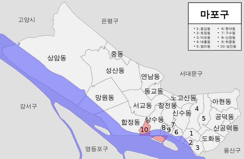
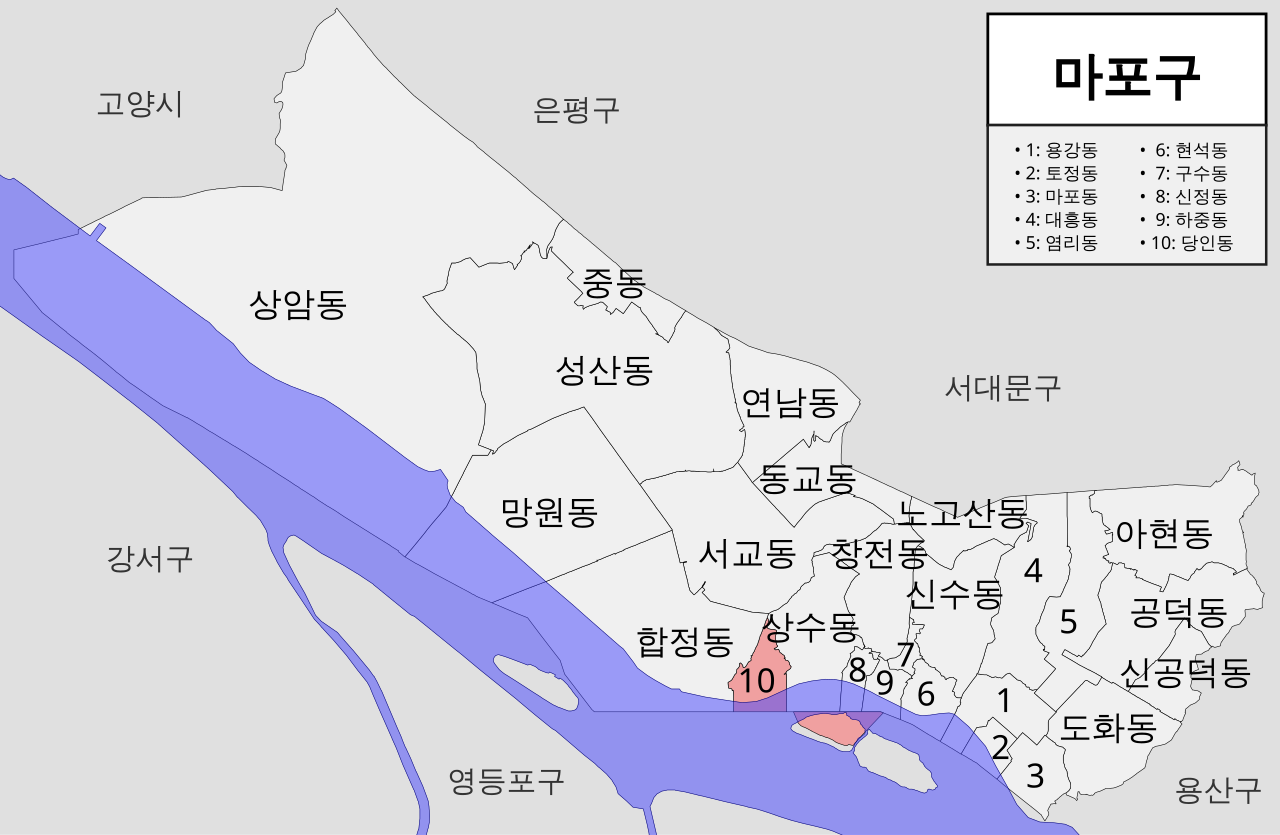
한국어: 서울특별시 마포구 법정동 지도 |
| Date | |
| Source | Own work |
| Author | 2147483647 |
| SVG development |
Licensing edit
I, the copyright holder of this work, hereby publish it under the following license:
| This file is made available under the Creative Commons CC0 1.0 Universal Public Domain Dedication. | |
| The person who associated a work with this deed has dedicated the work to the public domain by waiving all of their rights to the work worldwide under copyright law, including all related and neighboring rights, to the extent allowed by law. You can copy, modify, distribute and perform the work, even for commercial purposes, all without asking permission.
|
File history
Click on a date/time to view the file as it appeared at that time.
| Date/Time | Thumbnail | Dimensions | User | Comment | |
|---|---|---|---|---|---|
| current | 14:11, 29 November 2017 | | 4,600 × 3,000 (77 KB) | 2147483647 (talk | contribs) | Now includes major rivers! |
| 06:13, 16 August 2017 |  | 4,600 × 3,000 (64 KB) | 2147483647 (talk | contribs) | User created page with UploadWizard |
You cannot overwrite this file.
File usage on Commons
There are no pages that use this file.
File usage on other wikis
The following other wikis use this file:
- Usage on ko.wikipedia.org