File:Map of Okinawa Islands.png
Size of this preview: 800 × 572 pixels. Other resolutions: 320 × 229 pixels | 640 × 458 pixels | 1,024 × 733 pixels | 1,280 × 916 pixels | 2,389 × 1,709 pixels.
Original file (2,389 × 1,709 pixels, file size: 951 KB, MIME type: image/png)
Captions
Captions
Add a one-line explanation of what this file represents
Summary
edit
| Description |
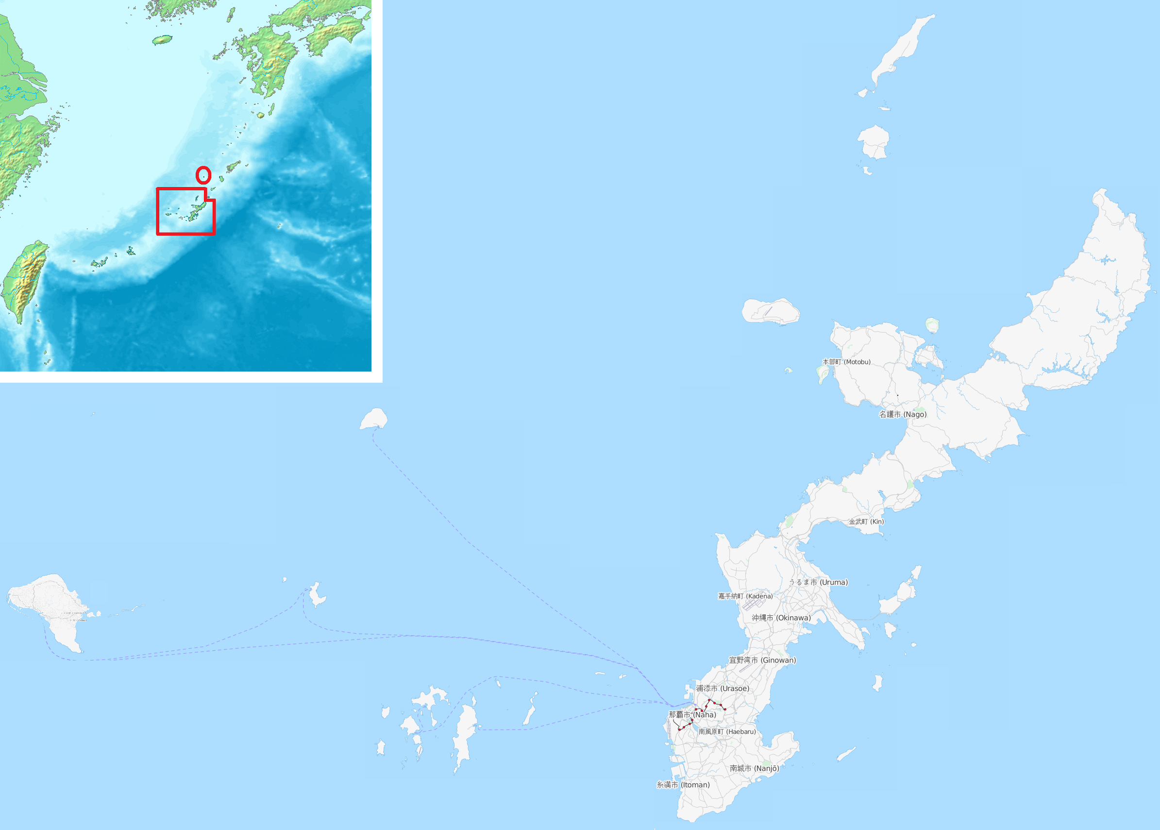
English: Map of Okinawa Islands (except for Io-torishima)
日本語: 沖縄諸島の地図(硫黄鳥島を除く) |
| Date | |
| Source | OpenStreetMap, File:Topographic15deg N20E120.png |
| Author | Retouched by Kugel |
Licensing
edit
| Description |
This map was created from OpenStreetMap project data, collected by the community. This map may be incomplete, and may contain errors. Don't rely solely on it for navigation. |
|||
| Date | (see file history) | |||
| Source | openstreetmap.org | |||
| Creator |
OpenStreetMap contributors |
|||
| Permission (Reusing this file) |
OpenStreetMap data is available under the Open Database License (details). Map tiles are licensed under the Creative Commons Attribution-ShareAlike 2.0 license (CC-BY-SA 2.0).
This file is licensed under the Creative Commons Attribution-Share Alike 2.0 Generic license.
|
|||
| Georeferencing | If inappropriate please set warp_status = skip to hide. |
File history
Click on a date/time to view the file as it appeared at that time.
| Date/Time | Thumbnail | Dimensions | User | Comment | |
|---|---|---|---|---|---|
| current | 00:52, 3 November 2014 | | 2,389 × 1,709 (951 KB) | Kugel~commonswiki (talk | contribs) | add map of Nansei Shoto |
| 08:07, 30 March 2014 |  | 2,389 × 1,709 (256 KB) | Kugel~commonswiki (talk | contribs) | {{Information |Description ={{en|1=Map of Okinawa Islands (except for Io-torishima)}} {{ja|1=沖縄諸島の地図(硫黄鳥島を除く)}} |Source =OpenStreetMap |Author =Retouched by Kugel |Date =2013-1... |
You cannot overwrite this file.
File usage on Commons
The following 2 pages use this file:
File usage on other wikis
The following other wikis use this file:
- Usage on ast.wikipedia.org
- Usage on ca.wikipedia.org
- Usage on fr.wiktionary.org
- Usage on ja.wikipedia.org
- Usage on ko.wikipedia.org
- Usage on no.wikipedia.org
- Usage on www.wikidata.org