File:Map of Oklahoma highlighting Oklahoma County.svg

Size of this PNG preview of this SVG file: 800 × 397 pixels. Other resolutions: 320 × 159 pixels | 640 × 317 pixels | 1,024 × 508 pixels | 1,280 × 635 pixels | 2,560 × 1,269 pixels | 7,730 × 3,832 pixels.
Original file (SVG file, nominally 7,730 × 3,832 pixels, file size: 67 KB)
Captions
Captions
Add a one-line explanation of what this file represents
Summary edit
| Description |
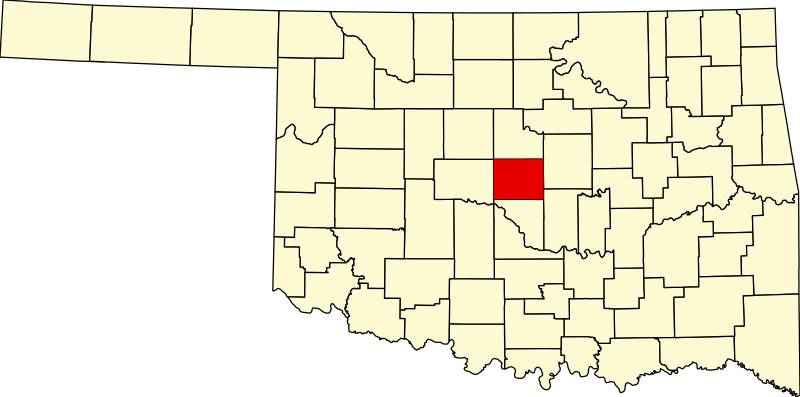
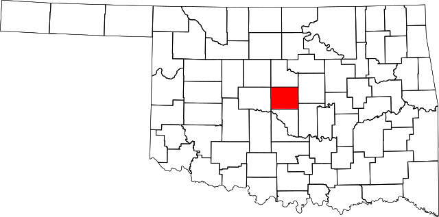
English: This is a locator map showing Oklahoma County in Oklahoma. For more information, see Commons:United States county locator maps. |
| Date | |
| Source |
Own work: English: The maps use data from nationalatlas.gov, specifically countyp020.tar.gz on the Raw Data Download page. The maps also use state outline data from statesp020.tar.gz. The Florida maps use hydrogm020.tar.gz to display Lake Okeechobee. |
| Author | David Benbennick |
Licensing edit
| I, the copyright holder of this work, release this work into the public domain. This applies worldwide. In some countries this may not be legally possible; if so: I grant anyone the right to use this work for any purpose, without any conditions, unless such conditions are required by law. |
File history
Click on a date/time to view the file as it appeared at that time.
| Date/Time | Thumbnail | Dimensions | User | Comment | |
|---|---|---|---|---|---|
| current | 10:51, 29 May 2022 | | 7,730 × 3,832 (67 KB) | GrandEscogriffe (talk | contribs) | correct locator map |
| 16:14, 12 February 2006 |  | 7,730 × 3,832 (57 KB) | David Benbennick (talk | contribs) | {{subst:User:Dbenbenn/clm|county=Oklahoma County|state=Oklahoma|type=county}} |
You cannot overwrite this file.
File usage on Commons
The following 7 pages use this file:
- File:2012 Oklahoma Democratic Primary by County.png
- Category:Births in Oklahoma County, Oklahoma
- Category:Deaths in Oklahoma County, Oklahoma
- Category:Geography of Oklahoma County, Oklahoma
- Category:Maps of Oklahoma County, Oklahoma
- Category:Oklahoma County, Oklahoma
- Category:People of Oklahoma County, Oklahoma
File usage on other wikis
The following other wikis use this file:
- Usage on ar.wikipedia.org
- أوكلاهوما سيتي (أوكلاهوما)
- مقاطعة أوكلاهوما (أوكلاهوما)
- بيثاني
- شوكتو
- ديل سيتي
- إدموند
- هارا
- ميدويست سيتي
- نيكولز هيلز
- نيكوما بارك
- سبنسر (أوكلاهوما)
- ذا فيليج
- وار أكريس
- فورست بارك (أوكلاهوما)
- جونس (أوكلاهوما)
- ليك ألوما (أوكلاهوما)
- لوتر (أوكلاهوما)
- أركاديا (أوكلاهوما)
- فالي بروك (أوكلاهوما)
- قالب:مقاطعة أوكلاهوما (أوكلاهوما)
- Usage on bg.wikipedia.org
- Usage on bpy.wikipedia.org
- Usage on ca.wikipedia.org
- Oklahoma City
- Arcadia (Oklahoma)
- Bethany (Oklahoma)
- Choctaw (Oklahoma)
- Del City
- Edmond (Oklahoma)
- Forest Park (Oklahoma)
- Harrah (Oklahoma)
- Jones (Oklahoma)
- Lake Aluma
- Luther (Oklahoma)
- Midwest City
- Nichols Hills
- Nicoma Park
- Spencer (Oklahoma)
- The Village (Oklahoma)
- Valley Brook
- Warr Acres
- Woodlawn Park (Oklahoma)
- Llista de comtats d'Oklahoma
- Categoria:Comtat d'Oklahoma
- Plantilla:Comtat d'Oklahoma
- Comtat d'Oklahoma
- Usage on cdo.wikipedia.org
- Usage on ceb.wikipedia.org
- Usage on cy.wikipedia.org
View more global usage of this file.