File:Map of Oklahoma highlighting Sequoyah County.svg

Size of this PNG preview of this SVG file: 800 × 397 pixels. Other resolutions: 320 × 159 pixels | 640 × 317 pixels | 1,024 × 508 pixels | 1,280 × 635 pixels | 2,560 × 1,269 pixels | 7,730 × 3,832 pixels.
Original file (SVG file, nominally 7,730 × 3,832 pixels, file size: 57 KB)
Captions
Captions
Add a one-line explanation of what this file represents
Summary
edit
| Description |
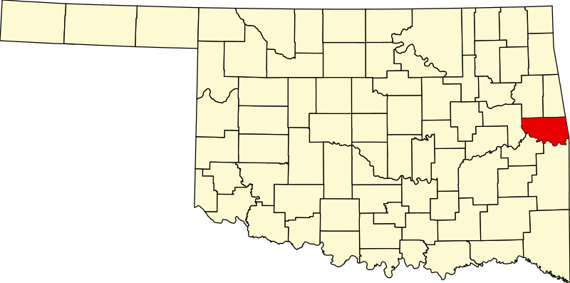
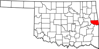
English: This is a locator map showing Sequoyah County in Oklahoma. For more information, see Commons:United States county locator maps. |
| Date | |
| Source |
Own work: English: The maps use data from nationalatlas.gov, specifically countyp020.tar.gz on the Raw Data Download page. The maps also use state outline data from statesp020.tar.gz. The Florida maps use hydrogm020.tar.gz to display Lake Okeechobee. |
| Author | David Benbennick |
Licensing
edit
| I, the copyright holder of this work, release this work into the public domain. This applies worldwide. In some countries this may not be legally possible; if so: I grant anyone the right to use this work for any purpose, without any conditions, unless such conditions are required by law. |
File history
Click on a date/time to view the file as it appeared at that time.
| Date/Time | Thumbnail | Dimensions | User | Comment | |
|---|---|---|---|---|---|
| current | 16:15, 12 February 2006 | | 7,730 × 3,832 (57 KB) | David Benbennick (talk | contribs) | {{subst:User:Dbenbenn/clm|county=Sequoyah County|state=Oklahoma|type=county}} |
You cannot overwrite this file.
File usage on Commons
The following page uses this file:
File usage on other wikis
The following other wikis use this file:
- Usage on ar.wikipedia.org
- Usage on bg.wikipedia.org
- Usage on bpy.wikipedia.org
- Usage on ca.wikipedia.org
- Akins
- Belfonte
- Brent (Oklahoma)
- Brushy
- Carlile
- Dwight Mission
- Evening Shade (Oklahoma)
- Flute Springs
- Gans (Oklahoma)
- Gore (Oklahoma)
- Long (Oklahoma)
- Marble City
- McKey
- Moffett
- Notchietown
- Paradise Hill
- Pinhook Corners
- Remy (Oklahoma)
- Roland (Oklahoma)
- Sallisaw
- Short (Oklahoma)
- Stony Point (Oklahoma)
- Sycamore (comtat de Sequoyah)
- Vian
- Llista de comtats d'Oklahoma
- Categoria:Comtat de Sequoyah
- Plantilla:Comtat de Sequoyah
- Usage on cdo.wikipedia.org
- Usage on ceb.wikipedia.org
- Usage on cy.wikipedia.org
- Usage on de.wikipedia.org
View more global usage of this file.