File:Map of Pakistan (2017).svg

Size of this PNG preview of this SVG file: 750 × 599 pixels. Other resolutions: 300 × 240 pixels | 601 × 480 pixels | 961 × 768 pixels | 1,280 × 1,023 pixels | 2,560 × 2,046 pixels | 2,362 × 1,888 pixels.
Original file (SVG file, nominally 2,362 × 1,888 pixels, file size: 1.15 MB)
Captions
Captions
Add a one-line explanation of what this file represents
Summary edit
| Description |
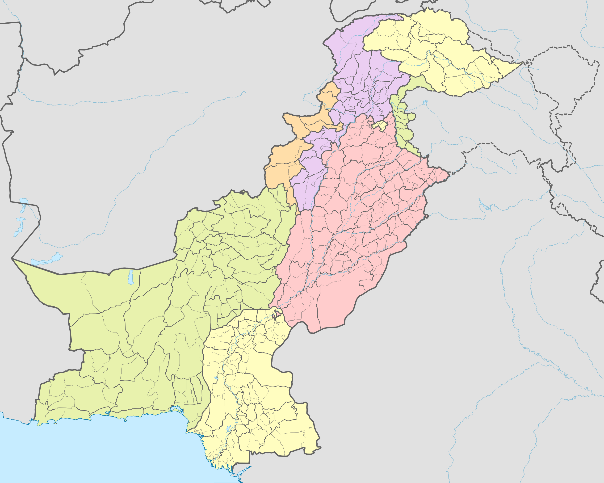
Español: Mapa de las subdivisiones de Pakistán (tehsils, distritos y provincias) en 2017. Los tehsils se corresponden al año 2007 pues no hay disponible información mas actualizada; los distritos se corresponden a los listados en el censo pakistaní de 2017 English: Map of the subdivisions of Pakistan (tehsils, districts and provinces) in 2017. The tehsils correspond to the year 2007 since more updated information is not available; the districts correspond to those listed in the 2017 Pakistani census |
| Date | |
| Source |
Own work based on: Pakistan adm location map.svg This file was derived from: |
| Author | Milenioscuro |
| Other versions |
|
.svg)
.svg&action=edit§ion=1)
Licensing edit
.svg&action=edit§ion=2)
I, the copyright holder of this work, hereby publish it under the following license:
This file is licensed under the Creative Commons Attribution-Share Alike 4.0 International license.
- You are free:
- to share – to copy, distribute and transmit the work
- to remix – to adapt the work
- Under the following conditions:
- attribution – You must give appropriate credit, provide a link to the license, and indicate if changes were made. You may do so in any reasonable manner, but not in any way that suggests the licensor endorses you or your use.
- share alike – If you remix, transform, or build upon the material, you must distribute your contributions under the same or compatible license as the original.
File history
Click on a date/time to view the file as it appeared at that time.
| Date/Time | Thumbnail | Dimensions | User | Comment | |
|---|---|---|---|---|---|
| current | 17:19, 12 May 2019 | | 2,362 × 1,888 (1.15 MB) | Milenioscuro (talk | contribs) | User created page with UploadWizard |
You cannot overwrite this file.
File usage on Commons
The following 2 pages use this file:
File usage on other wikis
The following other wikis use this file:
- Usage on en.wikipedia.org
- Usage on sd.wikipedia.org
.svg&oldid=512123698)