File:Map of SNG 2008-2014.png
No higher resolution available.
Map_of_SNG_2008-2014.png (800 × 547 pixels, file size: 107 KB, MIME type: image/png)
Captions
Captions
Add a one-line explanation of what this file represents
Summary
edit
| Description |
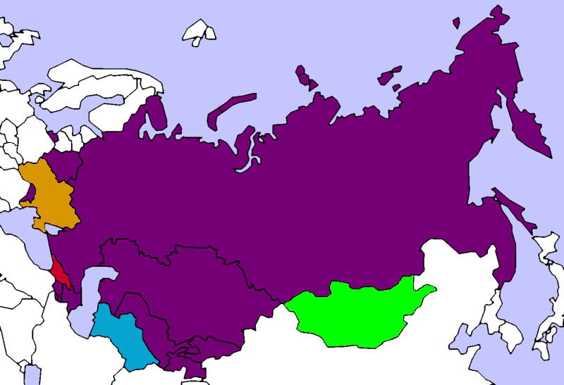
Français : La CEI entre le retrait de la Géorgie en 2008 et le retrait de l'Ukraine en 2014 |
| Date | |
| Source | File:Map of SNG.png |
| Author | Master Shadow (original version), Maphobbyist (this version) |
Licensing
edit
| This work has been released into the public domain by its author, Master Shadow & Maphobbyist. This applies worldwide. In some countries this may not be legally possible; if so: Master Shadow & Maphobbyist grants anyone the right to use this work for any purpose, without any conditions, unless such conditions are required by law.
|
File history
Click on a date/time to view the file as it appeared at that time.
| Date/Time | Thumbnail | Dimensions | User | Comment | |
|---|---|---|---|---|---|
| current | 01:58, 21 March 2014 | | 800 × 547 (107 KB) | SenseiAC (talk | contribs) | User created page with UploadWizard |
You cannot overwrite this file.
File usage on Commons
The following page uses this file:
- File:Map of SNG.png (file redirect)
File usage on other wikis
The following other wikis use this file:
- Usage on bg.wikipedia.org
- Usage on fr.wikipedia.org
- Usage on krc.wikipedia.org
- Usage on ru.wikinews.org