File:Map of South America (physical, political, population) with legend.jpg
Size of this preview: 417 × 599 pixels. Other resolutions: 167 × 240 pixels | 334 × 480 pixels | 535 × 768 pixels | 713 × 1,024 pixels | 1,427 × 2,048 pixels | 2,880 × 4,134 pixels.
Original file (2,880 × 4,134 pixels, file size: 2.68 MB, MIME type: image/jpeg)
Captions
Captions
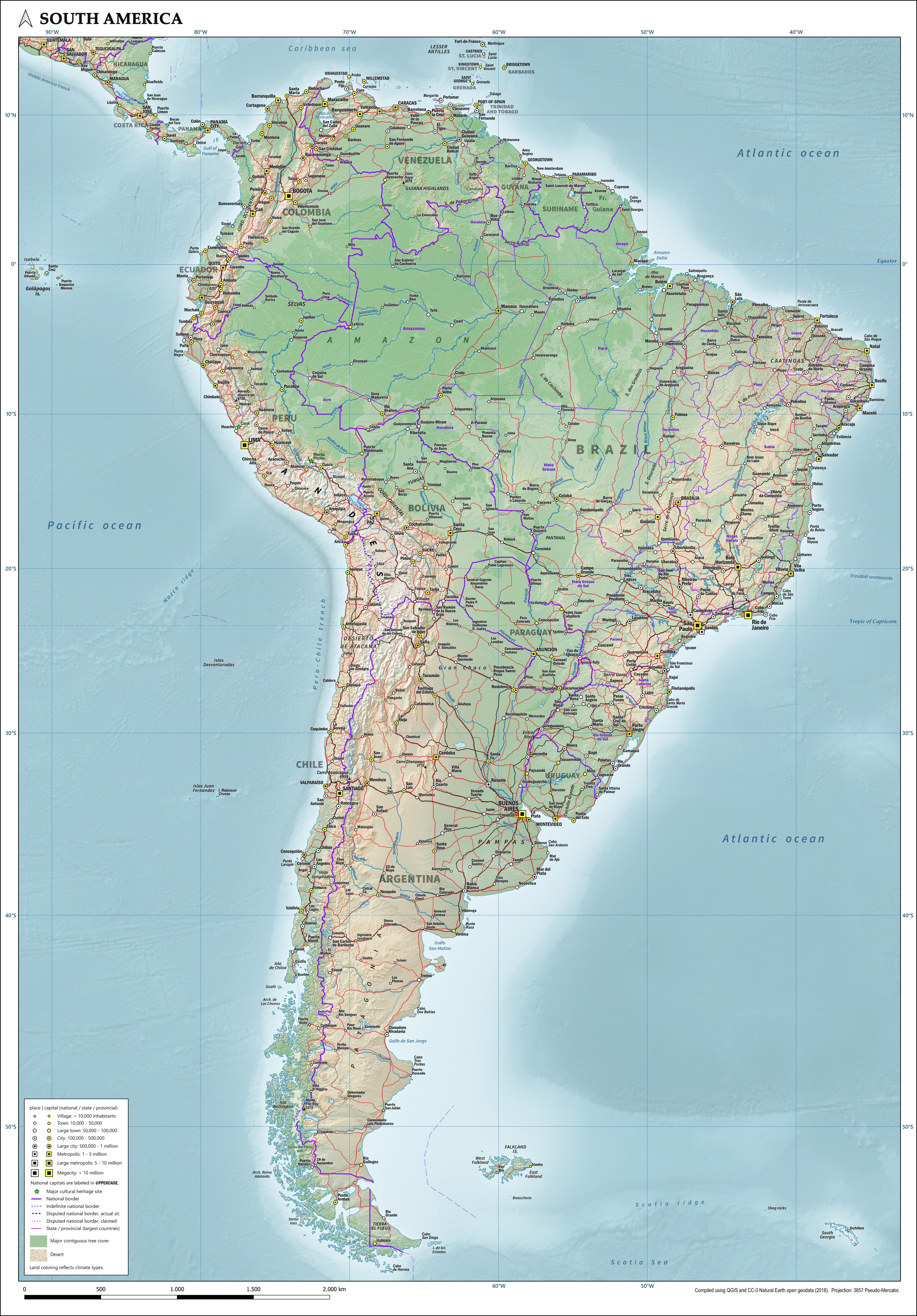
Map of South America showing physical, political and population characteristics, as per 2018
Summary edit
_with_legend.jpg&action=edit§ion=1)
| Description |
English: Map of South America showing physical, political and population characteristics, in Mercator projection, with legend, as per 2018. Compiled using QGIS and CC-0 Natural Earth geodata. |
| Date | |
| Source | Own work |
| Author | Janwillemvanaalst |
Licensing edit
_with_legend.jpg&action=edit§ion=2)
I, the copyright holder of this work, hereby publish it under the following license:
This file is licensed under the Creative Commons Attribution 4.0 International license.
- You are free:
- to share – to copy, distribute and transmit the work
- to remix – to adapt the work
- Under the following conditions:
- attribution – You must give appropriate credit, provide a link to the license, and indicate if changes were made. You may do so in any reasonable manner, but not in any way that suggests the licensor endorses you or your use.
File history
Click on a date/time to view the file as it appeared at that time.
| Date/Time | Thumbnail | Dimensions | User | Comment | |
|---|---|---|---|---|---|
| current | 06:15, 19 August 2020 | | 2,880 × 4,134 (2.68 MB) | Janwillemvanaalst (talk | contribs) | Uploaded own work with UploadWizard |
You cannot overwrite this file.
File usage on Commons
There are no pages that use this file.
File usage on other wikis
The following other wikis use this file:
- Usage on ab.wikipedia.org
- Usage on hy.wikipedia.org
- Usage on mnw.wikipedia.org
- Usage on mt.wikipedia.org
- Usage on no.wikipedia.org
- Usage on shn.wikipedia.org
_with_legend.jpg&oldid=697853456)