File:Map of Tennessee highlighting Monroe County.svg

Size of this PNG preview of this SVG file: 800 × 196 pixels. Other resolutions: 320 × 78 pixels | 640 × 157 pixels | 1,024 × 251 pixels | 1,280 × 314 pixels | 2,560 × 628 pixels | 7,814 × 1,916 pixels.
Original file (SVG file, nominally 7,814 × 1,916 pixels, file size: 98 KB)
Captions
Captions
Add a one-line explanation of what this file represents
Summary
edit
| Description |
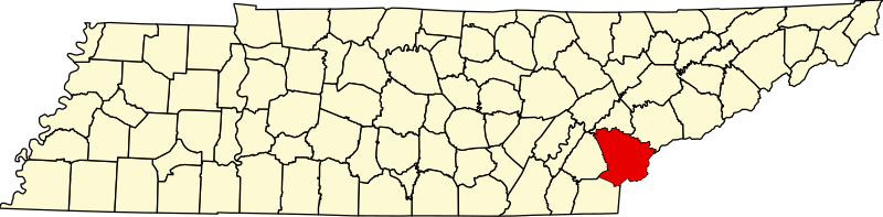
English: This is a locator map showing Monroe County in Tennessee. For more information, see Commons:United States county locator maps. |
| Date | |
| Source |
Own work: English: The maps use data from nationalatlas.gov, specifically countyp020.tar.gz on the Raw Data Download page. The maps also use state outline data from statesp020.tar.gz. The Florida maps use hydrogm020.tar.gz to display Lake Okeechobee. |
| Author | David Benbennick |
Licensing
edit
| I, the copyright holder of this work, release this work into the public domain. This applies worldwide. In some countries this may not be legally possible; if so: I grant anyone the right to use this work for any purpose, without any conditions, unless such conditions are required by law. |
File history
Click on a date/time to view the file as it appeared at that time.
| Date/Time | Thumbnail | Dimensions | User | Comment | |
|---|---|---|---|---|---|
| current | 16:34, 12 February 2006 | 7,814 × 1,916 (98 KB) | David Benbennick (talk | contribs) | {{subst:User:Dbenbenn/clm|county=Monroe County|state=Tennessee|type=county}} |
You cannot overwrite this file.
File usage on Commons
The following 3 pages use this file:
File usage on other wikis
The following other wikis use this file:
- Usage on ar.wikipedia.org
- Usage on bg.wikipedia.org
- Usage on bpy.wikipedia.org
- Usage on cdo.wikipedia.org
- Usage on ceb.wikipedia.org
- Usage on ce.wikipedia.org
- Usage on cy.wikipedia.org
- Usage on da.wikipedia.org
- Usage on de.wikipedia.org
- Usage on en.wikipedia.org
- Monroe County, Tennessee
- Madisonville, Tennessee
- Tellico Plains, Tennessee
- Vonore, Tennessee
- Sweetwater, Tennessee
- Sequoyah
- North River (Tennessee)
- Fort Loudoun State Historic Park
- Conasauga Creek
- Template:Monroe County, Tennessee
- User:Nyttend/County templates/TN
- Bald River Gorge Wilderness
- Gee Creek Wilderness
- Hopewell Mill, Tennessee
- Hopewell Springs, Tennessee
- National Register of Historic Places listings in Monroe County, Tennessee
- List of counties in Tennessee
- Callaways Little Island
- Jalapa, Tennessee
- Category:Populated places in Monroe County, Tennessee
- John McCroskey House
- Coker Creek, Tennessee
- Template:MonroeCountyTN-geo-stub
- Ballplay, Monroe County, Tennessee
- Haw Knob
- Rarity Bay, Tennessee
- Kahite, Tennessee
- File talk:Map of Tennessee highlighting Monroe County.svg
- Usage on eo.wikipedia.org
- Usage on es.wikipedia.org
View more global usage of this file.